Down time: I will be on holidays for the next week, and won’t be publishing any new posts during that time. I expect to resume posting on June 2. See you then!
Monthly Archives: May 2011
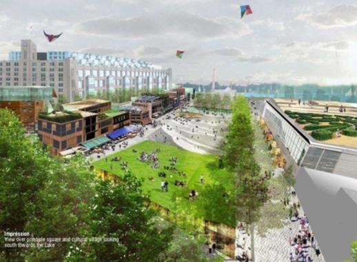
Construction of underground parking facility will create new public spaces for Harbourfront Centre
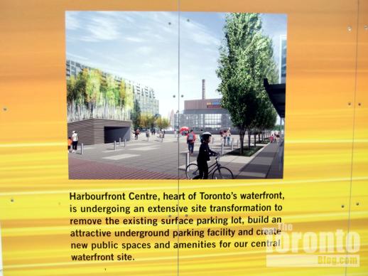
From the Centre’s website, this artistic illustration suggests how the revitalized Harbourfront Centre will look with new public parks and amenities on the space formerly occupied by a large above-ground parking lot
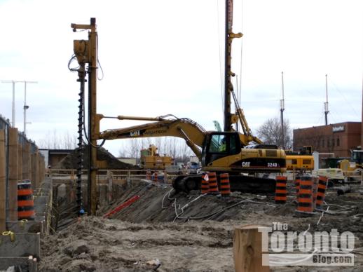
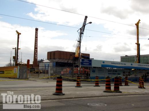
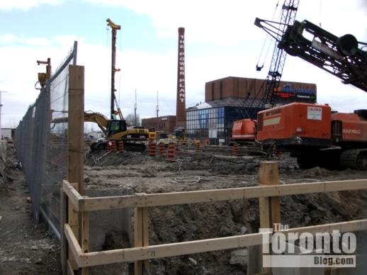
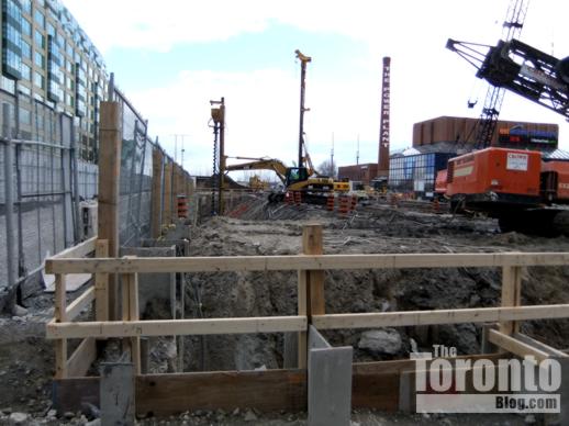
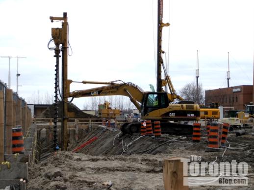
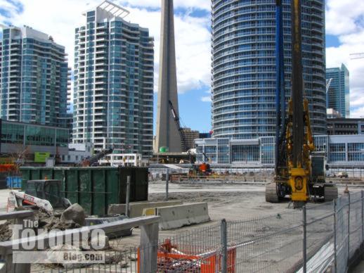
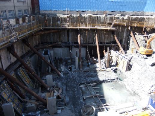
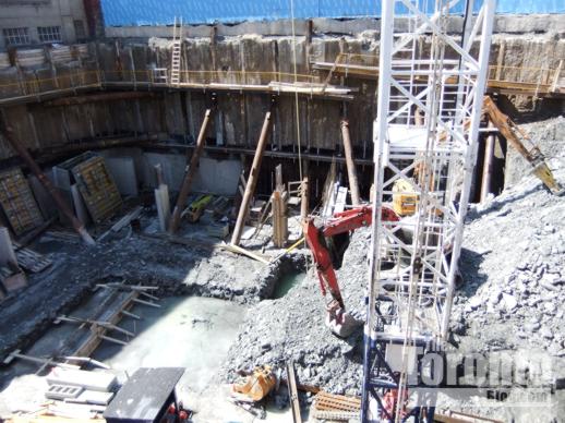
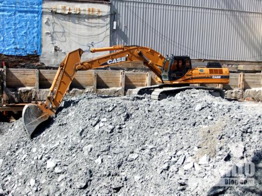
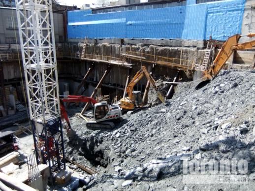
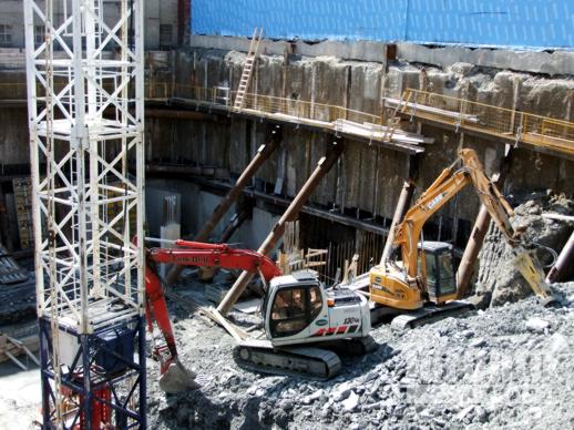
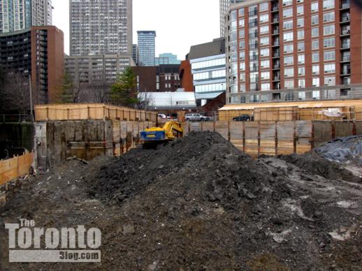
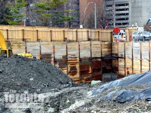
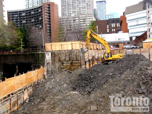
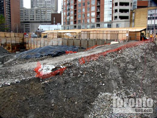
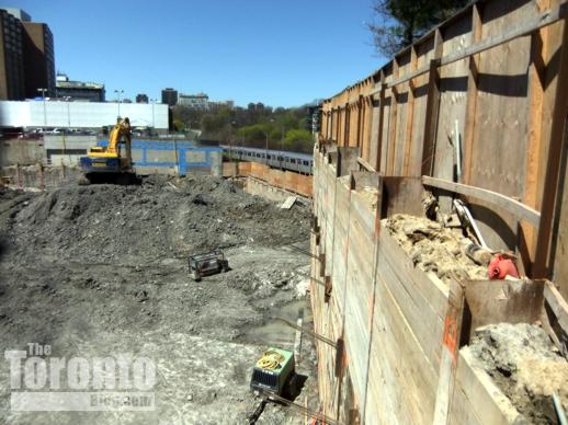
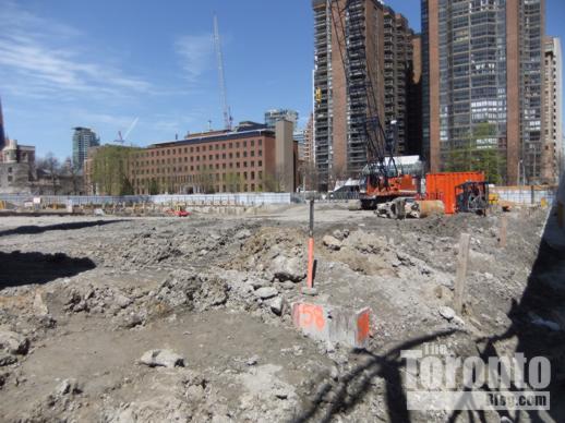
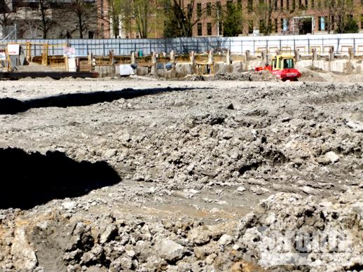
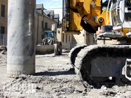
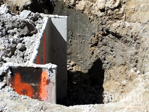
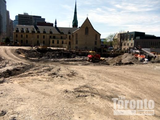
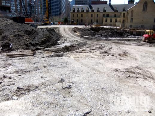
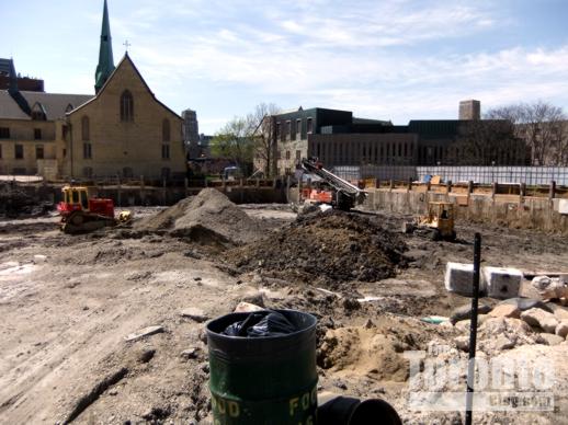
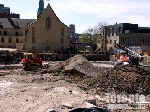
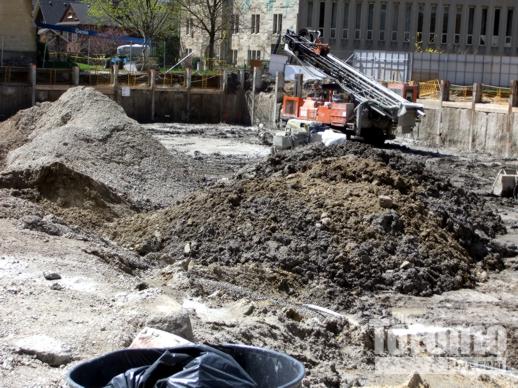
April 21 2011: Excavation of the existing above-ground parking lot is underway to build a new below-ground parking facility
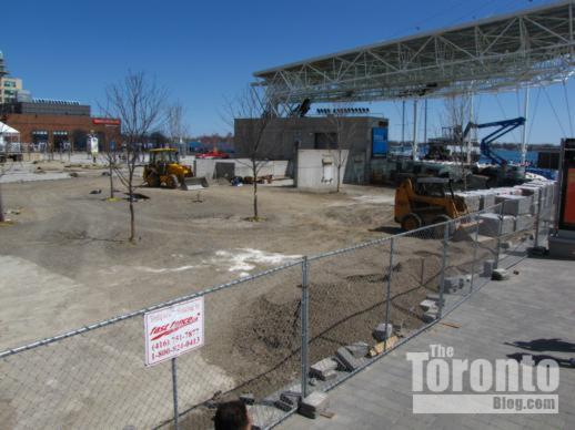
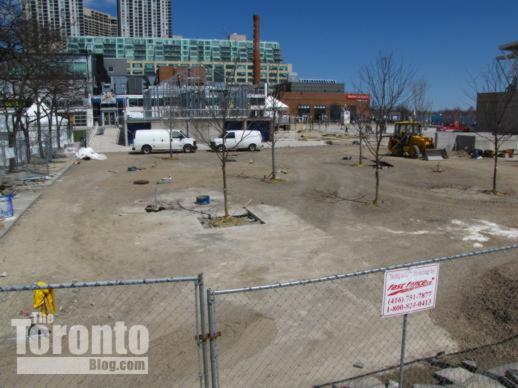
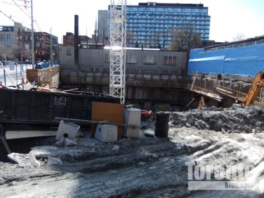
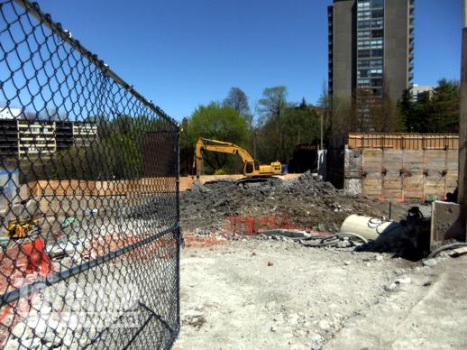
Site transformation: You can’t walk very far in downtown Toronto without encountering a “revitalization” project of some kind. Whether it’s public spaces like Nathan Phillips Square or the “mink mile” on Bloor Street, retail complexes like the Toronto Eaton Centre, transportation facilities like the Union subway station, or office towers like First Canadian Place, massive renovation and reconstruction projects are either underway, close to completion, or just getting started. Harbourfront Centre is no exception. The 10-acre cultural landmark is getting a major makeover that will create significant new public spaces at one of the city’s most popular waterfront attractions. The most visible work at the moment is excavation of the Centre’s large above-ground parking lot, which will be rebuilt — underground. That move will free up a tremendous amount of space to create new park and public amenity areas around the Harbourfront Centre facilities, which draw more than 12 million visitors annually. Although the parking lot is now a large, closed-off construction zone, it’s business as usual at the various Harbourfront Centre buildings, including Queen’s Quay Terminal, York Quay Centre, The Power Plant and the Enwave Theatre. Completion of the new underground parking lot is scheduled for next spring. Below are some recent photos of the revitalization activity underway at Harbourfront Centre.
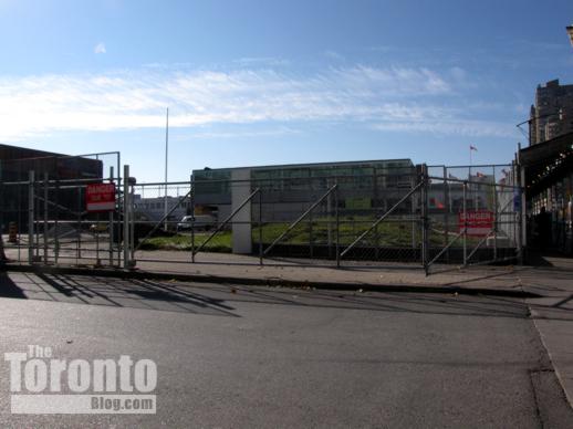
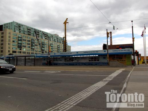
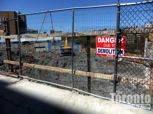
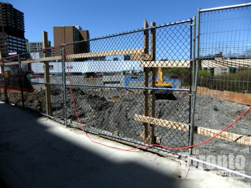
November 9 2011: The former parking lot for Harbourfront Centre has been cordoned off with fencing and hoarding as the revitalization project gets underway
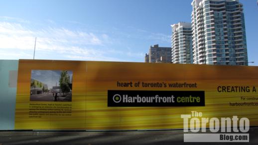
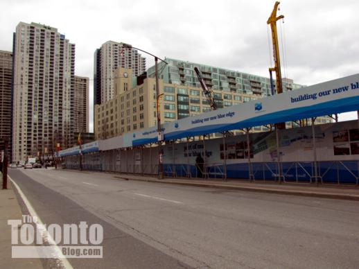
November 9 2011: Construction hoarding around the former parking site
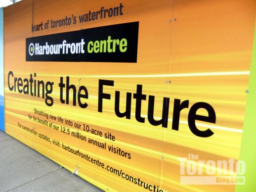
A billboard on hoarding around the Harbourfront Centre construction site
Another billboard at the Harbourfront Centre construction site
A diagram showing how the Harbourfront Centre site will be transformed
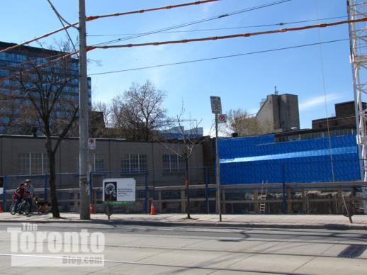
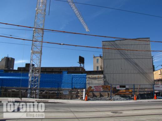
April 21 2011: Construction site hoarding along Queens Quay Boulevard
April 21 2011: Construction site hoarding along Queens Quay Boulevard
April 21 2011: Looking from Queen’s Quay Boulevard toward excavation activity at the northeast corner of the site
April 21 2011: Excavation activity at the northeast corner of the property
April 21 2011: Excavation activity along the eastern perimeter of the property, next to the Queen’s Quay Terminal building
April 21 2011: Construction of the new underground parking facility is expected to finish at around this time in 2012
May 8 2011: Looking northwest at the Harbourfront Centre construction site from the driveway next to the Queen’s Quay Terminal building
May 8 2011: Landscape reconstruction activity north of the lakeside amphitheatre
May 8 2011: Another view of landscaping activity behind the amphitheatre
Toronto planners tackle tall building conundrum: Where should towers be built? How high? What guidelines should govern their construction?
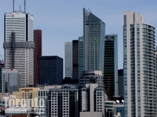
Office towers and highrise condo buildings in downtown Toronto’s Financial District, viewed from the Bathurst Street bridge to the west
Hello to high streets: If Toronto City Council ultimately adopts consultants’ recommendations, downtown residents could face a Sisyphean challenge fighting developers’ plans to build condo or office towers near their back yards — especially if those back yards face a “high street” deemed appropriate for tall building construction.
In a study submitted to the City last year, consultants identified 17 “high streets” — major downtown thoroughfares “on which tall buildings are currently located and where they are an appropriate form of development.” The consultants highlighted “the characteristics of those streets that should be supported and enhanced through tall building development,” and suggested a range of heights that should be permitted for properties fronting onto those streets. They also identified “secondary high streets” that they defined as “mostly residential streets that run between and adjacent to high streets on which tall buildings are an appropriate form of development, but at a lower scale than the adjacent high streets.” These streets “should be approximately one-third lower than the high streets they run parallel to,” the consultants said, “based on the downtown vision for the tallest buildings to be located on the high streets, and on the existing built form along many of the secondary high streets.”
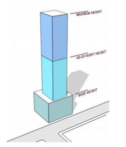 For the designated high streets, the consultants recommended that the City impose a three-tiered height limit for new building construction: a “base building height,” an “as of right” height, and a “maximum” height. The “base height” would be equal to the width of the high street on which the property has frontage. The “as of right” height would be based on prevailing heights of existing buildings nearby. Based on all recent building approvals, the “maximum” height would be available only through a “site-specific rezoning” that would require the building developer to provide what are known as Section 37 community benefits. The actual value of those benefits would be based upon the additional increase in building density that would accompany the increase in height between the “as of right” and “maximum” heights.
The consultants also recommended that all tall building proposals be evaluated according to a list of 17 “performance standards” — regulations that would govern important elements of building design including podium height and size, street level facades, tower setbacks, gross floor area, parking and utility access, shadow impact, and more. These regulations should be integrated into the City’s policy framework, they said, through amendments to the Official Plan, zoning bylaws and the City’s “Design Criteria for Review of Tall Building Proposals.”
Additionally, they suggested that the city should take steps to protect “view corridors” toward three landmark public buildings — Queen’s Park, Old City Hall and City Hall — and to outline how new tall building development must respect and relate to listed and designated heritage buildings.
The study, “Tall Buildings: Inviting Change in Downtown Toronto,” was commissioned by the City in 2007 and conducted by Urban Strategies Inc. and Hariri Pontarini Architects, working in consultation with city planning staff. The consultants examined the downtown area bounded by Bathurst Street in the west, the rail corridor above Dupont Street on the north, the Don Valley Parkway on the east and Front Street on the south. (The study specifically excluded nine “secondary plan areas” for which the City already has a “strategic vision and policies in place”: University of Toronto; King-Spadina; Fort York Neighbourhood; Railway Lands West; Railway Lands Central; Railway Lands East; Central Waterfront; King-Parliament; and Regent Park.)
According to Toronto’s City Planning Division, the study “focuses on protecting the quality of life of people living and working downtown, including their need for safe and comfortable public and private spaces for living and working, with access to natural light and views to the sky. It also focuses on ways to maintain and improve the enjoyment and usability of public streets, parks, and other elements relating to the public realm. Toronto’s streets, parks and squares, views of its iconic buildings, its heritage buildings, are all ways through which people experience their city, and they should reflect the desired image of downtown as stated in the City’s Official Plan — comfortable, cosmopolitan, vibrant and diverse.”
The consultants presented their report to city planners in April 2010. Over the course of the year that has passed since then, the City’s planning department has met with professional groups and industry associations to discuss the recommendations. Last month, the planners held public meetings at three separate downtown locations to get feedback from the community.
I attended the meeting held for Ward 27 residents at St. Basil’s Church on St. Joseph Street which, coincidentally, sits beside a tall building construction site on Bay Street ( U Condos, where site excavation has commenced for two condominium towers that will stand 45 and 50 floors tall, respectively).
Robert Freedman, the City of Toronto’s Director of Urban Design, told more than 100 people attending the meeting that city planning staff are studying the report so they can figure out how the city could implement the recommendations. “We hope to have a one-stop shop of guidelines for tall buildings,” added Helen Bulat, the City’s Project Manager of City Planning.
But the report itself, and its recommendations, will not be going directly to Toronto City Council for approval and implementation, said Gregg Lintern, the Director of Toronto & East York District Community Planning. Instead, city staff will “distill” recommendations from the consultants’ report and prepare their own report advising City Council what to do. Staff are hoping to bring that report to Council this fall, he said.
Frank Lewinberg, a partner with Urban Strategies, and David Pontarini, a partner with Hariri Pontarini, told the audience how the consultants undertook their study and reached their recommendations, and discussed some of the highlights of their report. (Full details of the process are outlined on the Tall Building Study page of the City’s website.)
Where are the high streets?
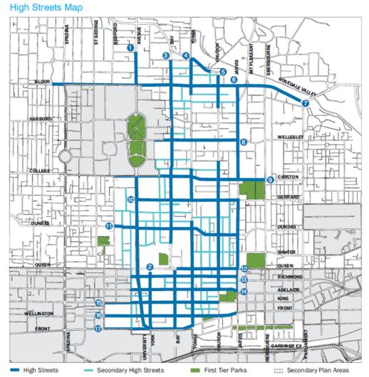
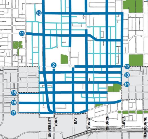
The study determined that tall buildings are appropriate for 17 downtown streets: University Avenue/Avenue Road; York Street; Bay Street; Yonge Street; Church Street; Jarvis Street; Bloor Street; Wellesley Street; College/Carlton Street; Gerrard Street; Dundas Street; Queen Street; Richmond Street; Adelaide Street; King Street; Wellington Street; and Front Street. High streets are indicated in blue on the maps below:
Downtown “high streets” have been highlighted in blue on this map from the City’s Tall Building Study webpage
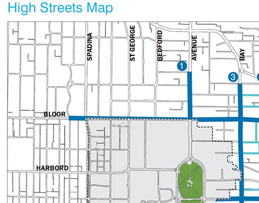
High streets to the north and west of Queen’s Park include Bloor and Bay and part of Avenue Road, as marked on this map from the City’s Tall Building Study webpage
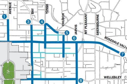
High streets to the north and east of Queen’s Park include Bloor as far east as Parliament Street, Wellesley as far east as Jarvis Street, Jarvis from Wellesley north to Bloor, and parts of Yonge and Church Streets near Bloor.
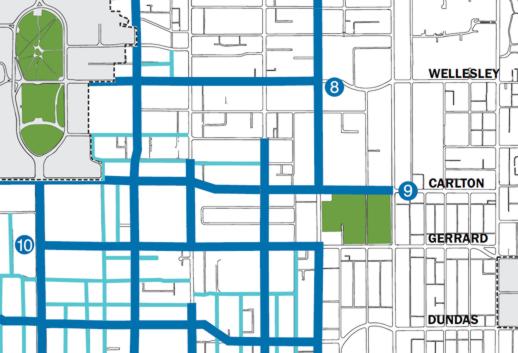
High streets southeast of Queen’s Park include College/Carlton as far east as Sherbourne, Gerrard between University Avenue and Jarvis, and Dundas to Jarvis.
High Streets in Toronto’s Financial District include the major east-west arteries of Queen, Richmond, Adelaide, King, Wellington and Front Streets, as well as the major north-south streets: University Avenue plus York, Bay and Yonge Streets
High street height ranges
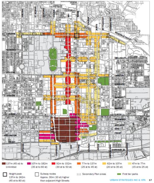
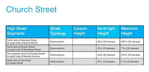
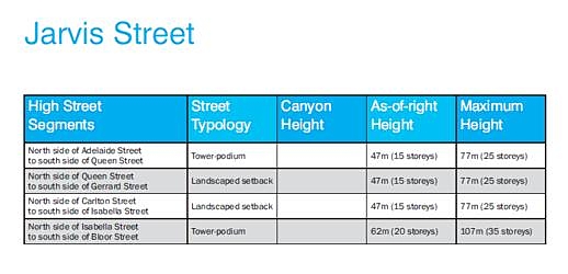
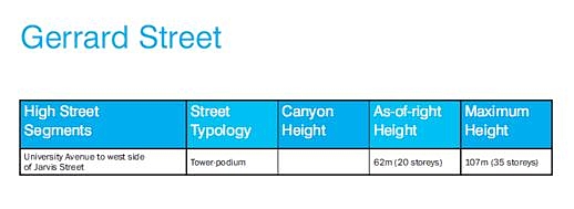
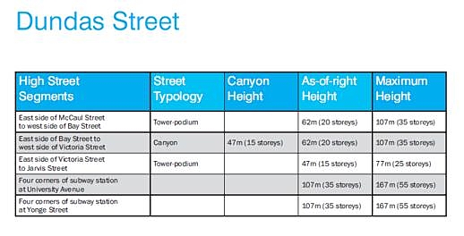
The consultants recommended six height range categories for buildings fronting on high streets: 47 to 77 meters (15 to 25 storeys), 62 to 107 meters (20 to 35 storeys), 77 to 137 meters (25 to 45 storeys), 92 to 152 meters (30 to 50 storeys), 107 to 182 meters (35 to 60 storeys), and 137 meters and up (45 storeys and higher).
At the same time, however, the consultants acknowledged that “not all segments of high streets have the same character. Much of a street’s character is determined by the existing buildings which line it and the public amenities that surround it.” Consequently, they identified the “general typologies” of buildings along high streets — “important elements of the character that should be preserved and/or enhanced” — and recommended that these typologies be continued along identified high street segments.
The four typologies include the tower-podium form (“slender towers spaced apart and set atop pedestrian-scaled podiums”); the canyon form (“high streetwalls with buildings that have been built to cover the full width of their sites”); the landscaped setback form (“tall buildings that are set back from the front property lines with a landscaped buffer between the buildings and the public right of way”); and the secondary high street form (found along designated secondary high streets that run between and adjacent to high streets and which are lined mostly with apartment buildings. Tall buildings are appropriate here, but on a lower scale than the adjacent high streets.)
Toronto downtown vision height map, from the Tall Buildings Study webpage
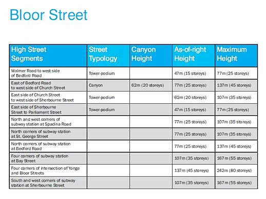
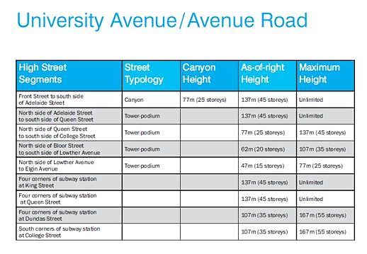
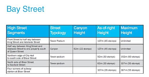
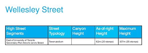
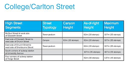
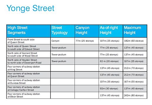
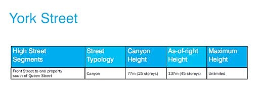
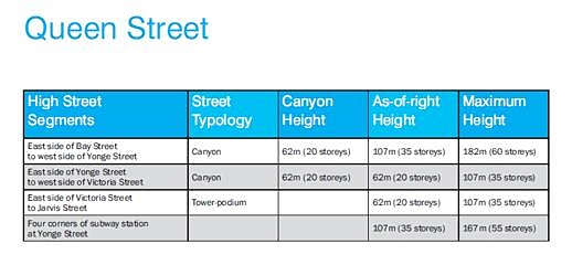
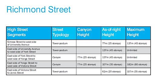
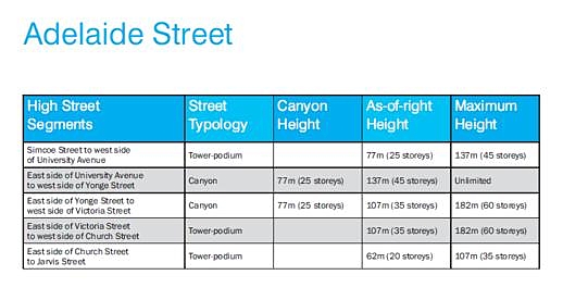
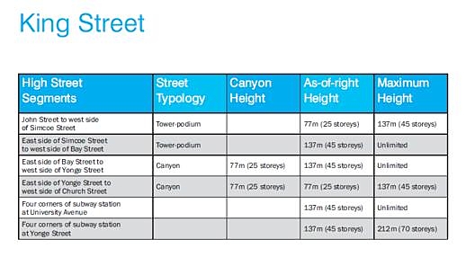
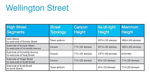
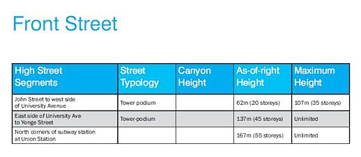
The charts below, also from the City’s Tall Buildings Study webpage, outline street typologies and height recommendations for specific designated high streets:
Some of the highlights Mr. Lewinberg drew to the audience’s attention included the recommendations that: 45 storeys be a base height for most of the Financial District, with no upper height limit; for the “shoulders” of the Financial District, the base should be 35 storeys and the maximum 60; for each of the four corners at Yonge & Bloor there should be 80 storey maximum heights; on Bay Street, there should be a 30 storey base and 50 storey maximum; and on parts of University Avenue, Bloor Street and lower Yonge Street, the base should be 25 storeys and the maximum 45.
“We deliberately left out parts of Yonge as to be not redeveloped. We decided Yonge Street was not the place for a high building,” Mr. Lewinberg said. Mr. Lintern added that the consultants and city staff recognize that Toronto residents have a “strong attachment” to a Yonge Street bathed in sunlight” thanks to a 20-meter “shelf” of pedestrian shopping from College/Carlton to Bloor. The bright, open nature of Yonge Street, thanks to the lower buildings that presently line much of the street, is considered “a marquee characteristic of Toronto,” he said.
What was the audience reaction?
Various maps and diagrams, including some of the ones I’ve posted above (from the City website), were available for viewing on display boards in the meeting room. Most of the comments I overheard people making were along the lines of “that’s interesting,” “that makes sense,” or “no limit in the Financial District — that’s OK.” I didn’t hear anyone complain that the recommended height limits were too high. Some people did express surprise, however, that height limits were not identified for specific parts of Yonge between Bloor and Carlton.
During the question period that followed the presentation, one audience member said it isn’t building height that upsets many “not in my back yard” tall building opponents, but rather how each specific building relates to its immediate neighbourhood as well as the street it fronts. Others agreed, with several questioning whether there is sufficient city infrastructure to support the recent surge of development, let alone all the condo towers currently in the pipeline. “Where are the parks? Where are the libraries? Where are the daycares? Where are the community centres?” one woman asked. But as one man in the audience observed, the neighbourhood around St Basil’s Church doesn’t have any of those amenities, notwithstanding the fact it has been a hotbed of condo construction lately with more buildings on the way. “We don’t even have a community centre, which is why this meeting is being held in a church basement,” he pointed out. Another speaker said she didn’t think the report’s endorsement of podiums was such a great idea. She noted that when tower podiums are built right to the property line, there often isn’t much room left for sidewalks, let alone street furniture, trees and landscaping that could make the streetscape more inviting and enjoyable. “Why can’t we get a decent sidewalk in this city?” she asked, noting that on parts of Avenue Road near Bloor, there is barely enough room to push a baby stroller past oncoming pedestrians.
Another audience member said she thought the consultant’s recommendations were sensible, but she was worried that by the time City Council acts on the report, developers will have scooped up most available downtown properties and begun building towers with heights much higher than the limits proposed for many of the high streets. She suggested the City should put a moratorium on further development until it can act on the report. But Mr. Lintern said City planners did not get the impression that developers have been rushing to beat the study’s release. The City has been studying tall buildings for the past 15 years, he noted, while downtown construction has been booming for about as long.
However, at least two people pointed out that some condo towers currently under construction on Yonge between Carlton and Bloor, and on Jarvis Street near Bloor, will stand considerably taller than the limits recommended by the consultants, and more are on the way. (Indeed, earlier this month a developer filed an application to build two 58-storey condo towers at 501 Yonge Street, on part of the street that the study authors and even Mr. Lintern specifically said was “not the place for a high building.” See my May 13 2011 post for further details on that condo development proposal.)
Several people said they wished the recommendations had “more teeth,” so that developers who don’t get the height and density they want from City Hall can’t appeal to the Ontario Municipal Board, which many believe overwhelmingly favours developers and builders over city residents. But Mr. Lintern pointed out that appeals to the OMB are a right provided under Ontario law — something the City can’t change. However, with the consultant’s report, the City is “trying to move from an era of ad hoc decision making to more predictable decisions,” he said. If the City has very clear regulations, then it’s much more likely to prevail when challenged before the OMB, he added. Nevertheless, he acknowledged, “there will always be some exceptions.”
Mr. Lintern said the City welcomes comments about the recommendations as well as any concerns about tall building development downtown. If you have a “pet peeve” of any kind, he said, “bring it to the attention of City Hall.” He said the City will accept comments and questions sent by email to: [email protected]
Conquering condo tower construction site cravings for concrete … with two Big Macks at a time
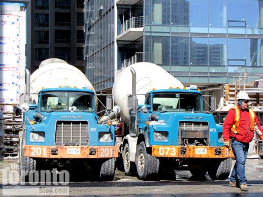
2 big Macks at the Four Seasons Toronto Hotel + condo construction site
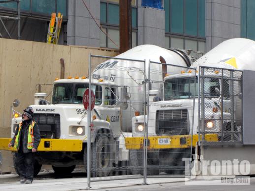
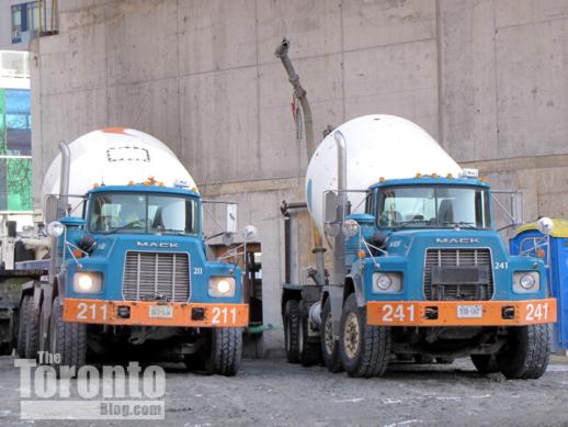
Happy Meal: I’ve noticed that, at some downtown condo and hotel construction sites, trucks pull up in pairs to deliver their loads of concrete. Here are pics of just three examples of where this happens regularly.
2 big Macks at the Trump Tower Toronto
2 big Macks at Burano condos
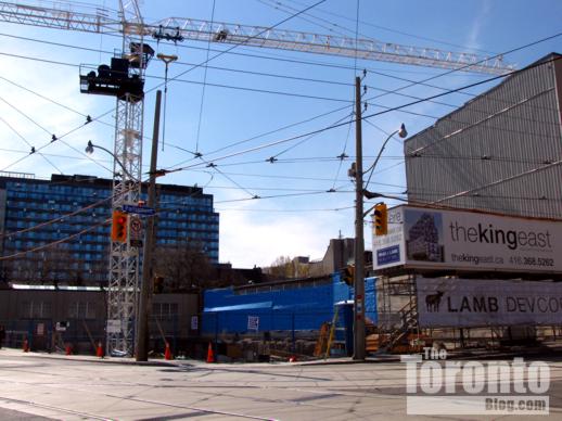
The King East “designer condominium” carving its niche at NW corner of King & Parliament
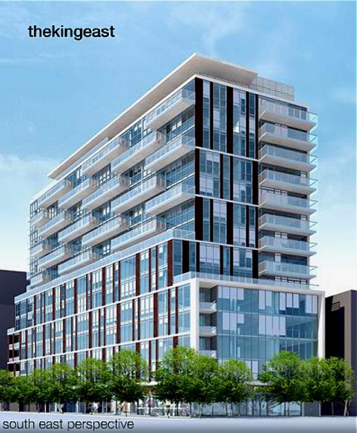
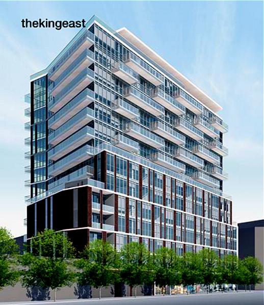
From The King East project website, this rendering suggests how the building will look from a southeast perspective…
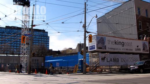
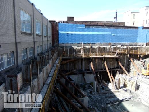
…and this is how The King East condo construction site appeared when viewed from the same perspective on April 30 2011
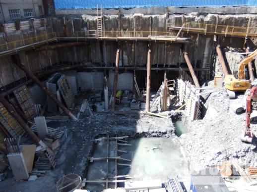
April 30 2011 view of excavation progress at the west end of the site for The King East condominium
Designer digs: Excavation work continues to progress on The King East, a 15-story condominium building billed by its developer as a “thrilling, pre-eminent architectural sculpture…crafted to push the design envelope to new heights.” The midrise condo will occupy the northwest corner of King and Parliament Streets, “one of the most historically significant corners of the original 10 blocks of the City of Toronto,” the project website states. Being marketed as a “designer condominium,” The King East is a project of Lamb Development Corp, Hyde Park Homes and The Sher Corporation. It will be noteworthy for its facade, which the condo website says will blend “patterns of red brick with bands of concrete, artfully connecting the glass podium by rising up the east and west face.” Below is another building rendering, from the project website, along wtih photos I shot at The King East construction site recently.
From the project website, another rendering of The King East condominium building
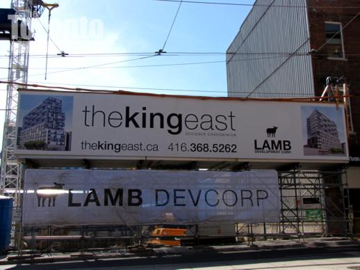
April 30 2011: The King East condo project signage on Parliament Street
April 30 2011: The far west end of the condo building construction site
April 30 2011: About one-third of the site has been excavated
April 30 2011: Looking down on the pit from the sidewalk along King Street East
April 30 2011: This machine has a lot of digging ahead
April 30 2011: Excavating machines digging deep at The King East condo building site
April 30 2011: A closer look at the excavators in the pit
April 30 2011: The King East excavation viewed from Parliament Street
April 30 2011: West side of the site viewed from across King Street East
April 30 2011: Looking across King Street toward the northeast side of the site
April 30 2011: A view of The King East construction site from the southeast corner of King & Parliament Streets
Nathan Phillips Square revitalization crawls along
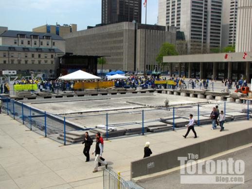
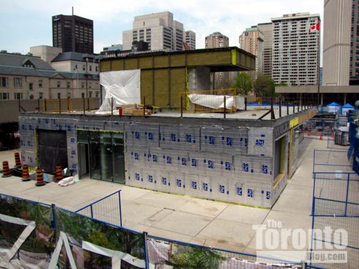
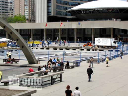
May 13 2011: Work still hasn’t finished on the former Peace Garden location
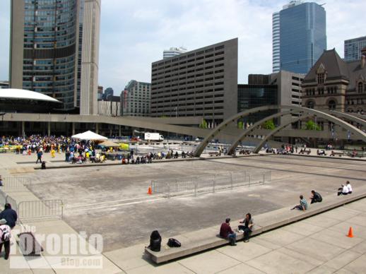
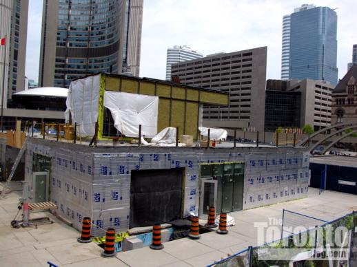
Snail’s pace: Looks like the Nathan Phillips Square revitalization is one of those ambitious city projects that is going to take years to complete … and probably not look much like the transformation that was initially promised to Toronto taxpayers. Every time I visit the Square, I expect to see signs of significant construction progress, but never do. While I do notice changes from time to time, I keep getting the distinct impression that the transformation appears to be moving at a snail’s pace. Now I know why. In her latest column in Saturday’s Globe and Mail, Lisa Rochon says “work has been seriously delayed on the square” because of “petty squabbles” between the contractor and the city — a dispute that could result in a two-year delay costing taxpayers an extra $2.4 million. (As I noted in my January 11 2011 post, the project was supposed to take only two years, and cost $42.7 million). I highly recommend reading Ms. Rochon’s column for further insight and information about the Nathan Phillips Square revitalization and other public space projects in Toronto. In the meantime, I’ve posted some recent pics of the Square’s construction progress (or lack thereof) below. Unless a lot of work and general spring cleaning happens in the next couple of weeks, the Square is destined to look tacky and dumpy throughout the summer tourist season. And that’s definitely not a good way to make a positive impression on the hundreds of out-of-town visitors who will pass through the Square each day.
May 13 2011: Without water and operating fountains, the big reflecting pool looks like a large rectangular dustbowl
May 13 2011: The new concession stand and skate rental facility was supposed to be finished by the end of last year, but still has a ways to go
May 13 2011: Another view of the concession building
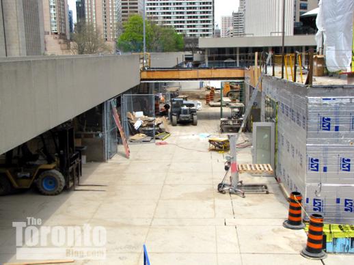
May 13 2011: A view of the bridge being built to link the concession building with the elevated walkway that surrounds Nathan Phillips Square
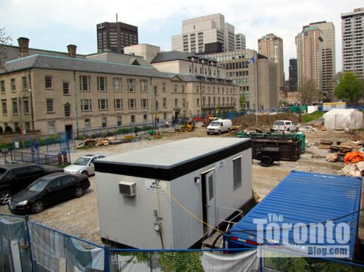
May 13 2011: The west end of the Square next to Osgoode Hall, where the Peace Garden is supposed to be relocated
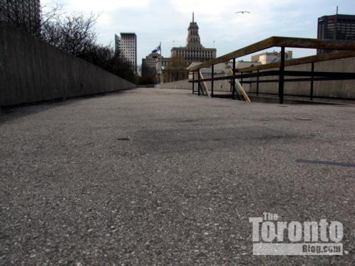
May 13 2011: After being closed all winter, the elevated walkways (and City Hall’s green roof park) have re-opened to the public. The walkways are supposed to get new surfacing and lighting as part of the Nathan Phillips Square revitalization.
May 13 2011: Another view of the former Peace Garden location, which has been taking months to rebuild as an open section of Nathan Phillips Square
City Scene: Streak of sunshine on 2 King East
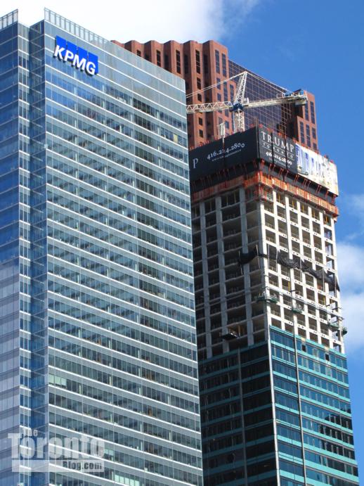
Trump Tower set to overtake Bay Adelaide Centre as it keeps rising on Financial District skyline
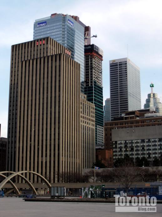
May 8 2011: Trump International Hotel and Tower Toronto construction progress viewed from Nathan Phillips Square
Getting taller: I keep waiting for the Trump International Hotel and Tower Toronto to make a big impact on my balcony view of the Financial District. For more than a month, I’ve been able to see the Trump Toronto’s rooftop construction crane poking above and behind the 51-storey Bay Adelaide Centre. But within a couple more weeks, I should finally be able to see the actual tower itself. Below are several recent photos showing the Trump Toronto’s progress ascending to the ranks of the city’s tallest buildings.
April 8 2011: Trump Toronto construction viewed from Nathan Phillips Square
April 23 2011: From my balcony, I can see the Trump’s construction crane poking out from behind the Bay Adelaide Centre building
April 23 2011: A zoom view of the Trump Toronto rising behind BAC
May 8 2011: Another view of Trump Toronto from City Hall
May 13 2011: Trump Toronto viewed from corner of Adelaide and York Streets
Developer proposes two 58-storey condo towers to replace retail/restaurant strip at 501 Yonge Street
May 13 2011: The 501 Yonge Street strip of retail shops and restaurants, viewed from the southwest corner of Yonge & Grosvenor Streets
Going big & tall on Yonge: In my Ripe for Redevelopment post on April 14 2011, I wondered what Lanterra Developments was planning to do with the 501 Yonge Street strip of restaurants and retail shops it had recently purchased — as well as when it was going to announce its plans. When I walked past 501 Yonge last week, I knew something was imminent because three of the former retail tenants have moved out, leaving suspiciously empty storefronts. Now I know what’s happening with the property — or should I say, what the developer hopes will happen.
The company has filed a development application with the city to build a mixed-use complex that would include two 58-storey condo towers and an entirely new retail strip along Yonge. The towers would soar 190 meters from a 7-storey podium featuring retail space at street level plus five levels of parking above that. The complex would contain 960 condo units, 302 residential parking spaces and 58 parking spots for visitors. Lobbies for the condo towers would sit at opposite ends of the block: the north tower lobby would be on Maitland Street, while the south tower lobby would be on Alexander Street. The city’s development application notice says that driveway and service access to the complex would be from Maitland Place; however, that’s clearly a mistake because Maitland Place is a one-block street two blocks east, between Homewood Avenue and Jarvis Street. They must have meant Maitland Street.
The city received the application only on May 5, so no community consultation meeting has been scheduled yet, nor has the developer publicly released renderings of its proposed towers. But I’m sure there will be strong opposition to the towers’ sheer height from some area residents, particularly those in the 18-storey Cosmopolitan condo building at 25 Maitland Street, which would be absolutely dwarfed by the 501 project. Will keep you posted on further news about this project. Below are two more pics from this afternoon, showing the vacant storefronts.
May 13 2011: Looking northeast toward the vacant retail outlets at 501 Yonge
May 13 2011: A body piercing shop is bookended by empty retail space; the 18-storey Cosmopolitan condo building on Maitland Street is visible at left rear
St Nicholas Street demolition derby revving up as wrecking machines arrive at FIVE Condos site
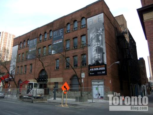
May 11 2011: A Link-Belt 290 excavating machine parked outside what will soon be a massive construction site for FIVE Condos
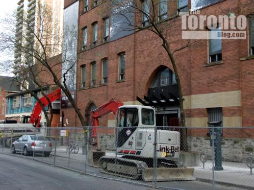
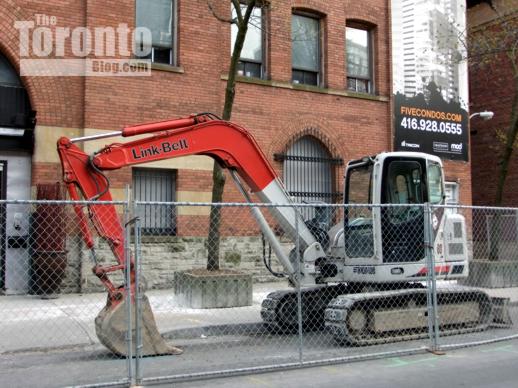
Ready to rumble: St Nicholas has long been one of my favourite downtown streets because it’s been a peaceful alternative to the hustle and bustle of Yonge Street whenever I have wanted to take a quiet walk north or south between Charles and Wellesley Streets. But that all changed last week. As I reported in a post yesterday, demolition crews have begun tearing down a building on the southeast corner of St Mary and St Nicholas Streets to make way for construction of the Nicholas Residences condo tower. Yesterday evening, I noticed two demolition machines two blocks south, parked outside a heritage building at the corner of St Nicholas and St Joseph Streets where the 45-storey tower for FIVE Condos will be built. With security fencing erected to cordon off the south side of St Joseph, demolition on the FIVE site appears imminent. Looks like I’ll have to start walking the linear city parks on the east side of Yonge for the next three years if I want to escape noise and traffic on my north-south walks! Below are several more pics of the heavy machinery set to start smashing down walls at the FIVE site. My April 28 2011 post has more photos and information about FIVE Condos.
May 11 2011: A security fence has been erected and demolition machines parked outside 5 St Joseph Street at the corner of St Nicholas Street, where the 45-storey FIVE Condos complex will be built
May 11 2011: Construction of the FIVE Condos complex, which will occupy one-third of the block between Yonge, St Joseph and St Nicholas Streets, is expected to take about three years
May 11 2011: A Link-Belt 80 excavating machine outside the FIVE Condos location at the corner of St Joseph and St Nicholas Streets
Toronto finally gets a “wow factor” attraction with CN Tower’s EdgeWalk for extreme thrillseekers
CN Tower’s new EdgeWalk thrill attraction opens August 1
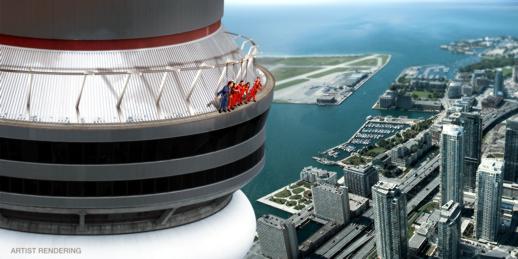
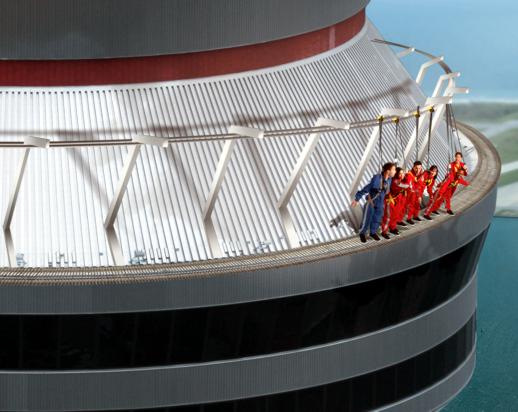
Harnessed to overhead safety rails, thrill seekers will be able to lean over the edge of the CN Tower roof for the ultimate bird’s eye view of Toronto — from 116 stories (1,168 feet) above the ground
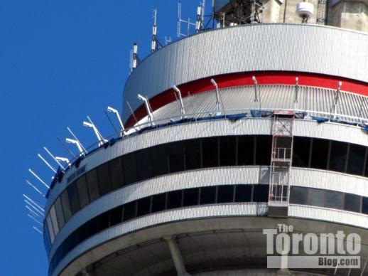
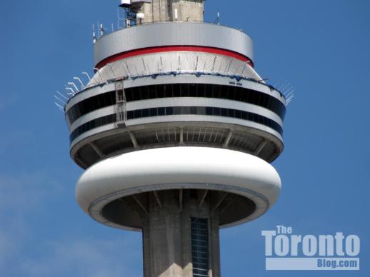
May 8 2011: EdgeWalk safety structure being installed on CN Tower
On the edge: I knew something big was in the works when I saw something I had never noticed before on the roof the main CN Tower observation deck pod last weekend. I was walking along Wellington Street West when a glint of sunshine off dozens of white metal posts protruding from the pod roof caught my eye. My camera’s zoom lens confirmed that something was being constructed on the roof, but what was it? A new window cleaning platform? Probably not. A new addition to the tower’s night-time exterior light show? I doubted that, too. Roof repairs? Perhaps — I could see what appeared to be blue tarps hanging over the edge of the pod. When I got back home, I double-checked other CN Tower photos I had taken recently to see how long the posts had been up there. They didn’t appear in any of my pics from late March, so I figured that construction had started during April so whatever was being done could be finished before Toronto’s summer tourist season gets into full swing. The CN Tower website didn’t mention anything new, so on Monday morning I emailed the tower one of my pics to ask what was going on. I got my answer when I returned home a few hours later and logged into facebook, where my news feed was filled with links friends had provided to an online Toronto Star report about the CN Tower’s new EdgeWalk extreme thrill attraction.
Opening August 1, EdgeWalk at the CN Tower will offer Toronto adventure seekers the ultimate adrenaline rush. Securely harnessed to an overhead safety rail, groups of six to eight daredevils will get to spend nearly half an hour taking a “hands-free” walk along a 5-foot-wide, 492-foot-long ledge circling the roof of the tower’s revolving restaurant, the 360.The harness system will let them lean perilously over the roof edge to see how far they can push their personal thrill boundaries while testing the limits of their anxious loved ones (It puts a whole new spin on the expression, “Look ma, no hands!”).
Though I noticed the EdgeWalk support structure only this past weekend, the project has been in the works for nearly 10 months. Design took four months, while fabrication took another three. Installation is expected to take around two months. Comprised of 36,000 pounds of steelwork, the EdgeWalk structure includes 112 pieces of 5-by-4-foot galvanized steel grated floor and 36 support arms. These arms are linked to two side-by-side 450-foot rails plus two 50-foot rails leading outside; one will be used for the tour group leader, while the other is for each group of EdgeWalkers.
The walks will last 20 to 30 minutes, but with pre-walk safety briefing, the whole EdgeWalk experience will take about 1.5 hours. The tower will offer two to three walks per hour, with up to 30 walks per day. The attraction will operate roughly from May or Otober, and the number of actual walks conducted will vary depending upon weather and sunrise/sunset times. Tickets will cost $175 and will go on sale beginning June 1.
Though this is an adventure I don’t have the guts to try myself, I think it’s a great new feature for the 35-year-old CN Tower — and a long-overdue new tourist attraction for Toronto. For years, I’ve seen newspaper and international travel magazine articles raving about Sydney, Australia’s famous Harbour Bridge Climb, and last year I saw a television program that profiled the SkyWalk and SkyJump at the Sky Tower in Aukland, New Zealand. Toronto didn’t have anything even remotely comparable, and I thought the city needed a new drawing-card with a tremendous “wow factor” to put itself on the map. The best “wows” the city had to offer were already at the CN Tower — the Glass Floor, which was installed in 1994, and the world’s highest glass floor-panelled elevator, which opened in 2008. I checked out the TripAdvisor.com Toronto forums to see what local residents were recommending to visiting tourists, and thought the list was pretty sad. It included the Eaton Centre and the St. Lawrence Market, both of which might wow shopping enthusiasts and foodies, along with Casa Loma, Harbourfront and the Toronto Islands. The only attractions I’ve seen mentioned favourably in international travel publications have been the Art Gallery of Ontario (AGO) and the Royal Ontario Museum (ROM). Though the ROM’s Michael Lee-Chin Crystal was named as one of “The new seven wonders of the world” in the April 2008 issue of Condé Nast Traveler magazine, I thought the city still needed something more — something really big and exciting — to catch international attention. EdgeWalk ought to do it.
Below is a CN Tower ad for EdgeWalk, along with some of my recent pics of the tower.
From the CN Tower website, an advertisement for EdgeWalk at the CN Tower
March 29 2011: Installation of the EdgeWalk structure hasn’t yet started, as this photo of the CN Tower — shot from Concord CityPlace to its west — indicates
March 29 2011: No signs of any EdgeWalk structure on the northeast side of the CN Tower, either, seen here peeking from behind The Ritz-Carlton Toronto
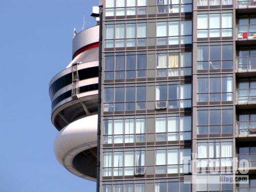
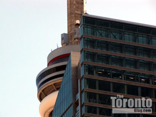
May 8 2011: EdgeWalk’s newly-installed steel support arms caught my attention
May 8 2011: A closer look at the EdgeWalk steel support arms
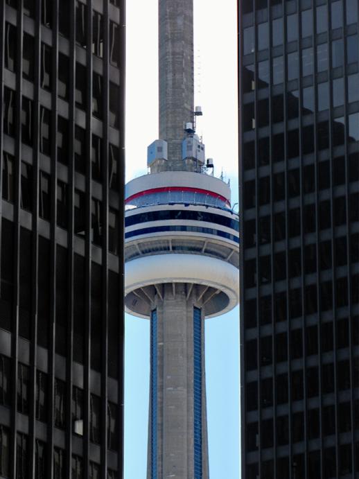
May 8 2011: CN Tower viewed from the corner of King & Bay Streets
Crews razing former Jesuit college to prepare site for Nicholas Residences condo construction
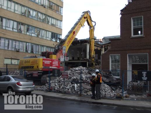
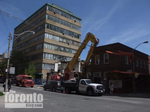
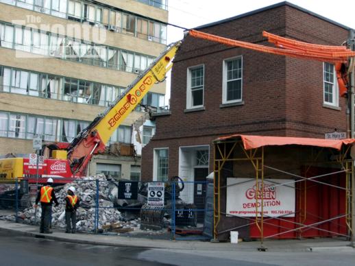
May 6 2011: Hoarding is up and a demolition machine has been positioned to prepare for demolition of the former Regis College buildings.
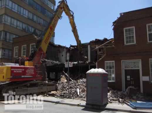
May 9 2011: Crews have pulled down roughly one-third of the building
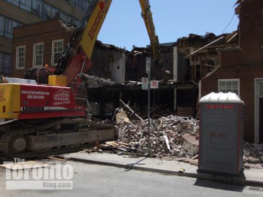
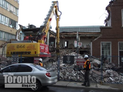
May 11 2011: Almost half of the structure has now been reduced to rubble
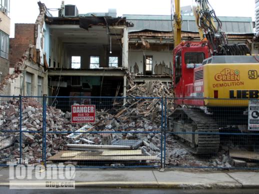
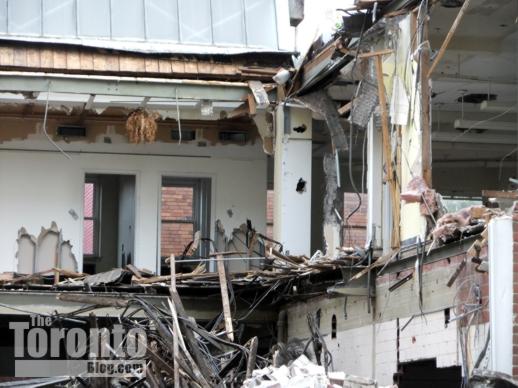
Tumbling down: The brick building that once housed Regis College, the Jesuit Graduate Faculty of Theology at the University of Toronto, is almost gone. During the past two days, demolition crews have knocked down nearly half of the building at the southeast corner of St Nicholas and St Mary Streets. They’re expected to finish smashing down the rest of the brick walls by the weekend. Once the structure is cleared from the site, construction can commence on the 35-storey Nicholas Residences condo tower. Below are photos of this week’s demolition activity; to view pictures of the former Regis College buildings before the wrecking crews arrived, check out my May 7 2011 Neighbourhood Watch post, as well as my more detailed March 31 2011 post about the Nicholas Residences project.
May 9 2011: Demolition crew smashes down the building’s north facade on St Mary Street, next to the Church of Scientology Toronto building
May 9 2011: The ground floor was reinforced so the demolition machine can drive into the middle of the building and knock out the east, south and west walls.
May 11 2011: Most of the northeast corner section of the building had been destroyed by the time the demolition crews went to lunch today.
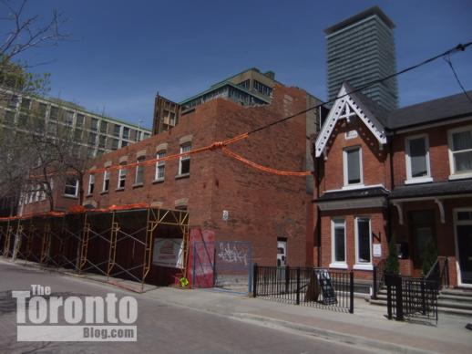
May 11 2011: Most of the third floor has been removed from the former college building at 67 St Nicholas Street, which was built as a planing mill in the 1880s. The facade is supposed to be rebuilt as part of the condo complex.
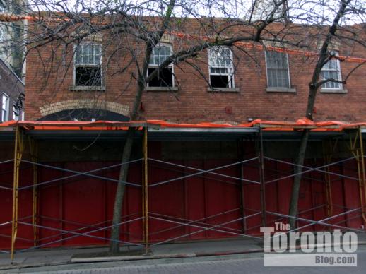
May 11 2011 Hoarding protects the sidewalk outside 67 St Nicholas Street where the third floor has already been demolished
May 11 2011: The northeast third of the building has been razed
May 11 2011: Almost all of the St Nicholas Street facade has been knocked down
May 11 2011: The inside of the building was gutted during March and April
May 11 2011: This structure should be rubble by the weekend
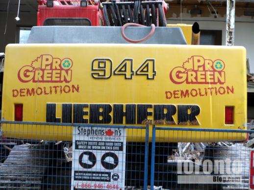
May 11 2011: The Liebherr R 944 C Litronic is a multipurpose excavating machine. Here, its purpose is to destroy the old Regis College building.
Demolition clearing way for construction to start on 4-storey office building at Huntley & Isabella
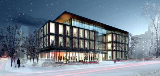
This rendering, provided courtesy of KPMB Architects in Toronto, illustrates a southwest winter view of the new offices to be built at Huntley & Isabella Streets for The Elementary Teachers’ Federation of Ontario (ETFO) …
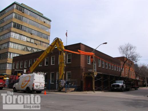
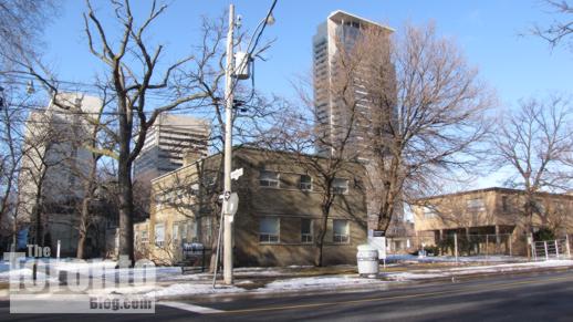
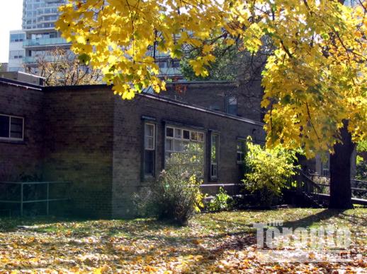
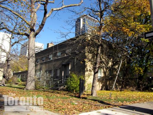
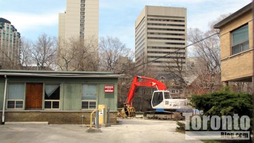
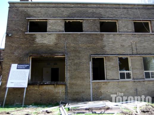
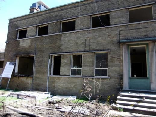
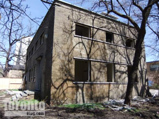
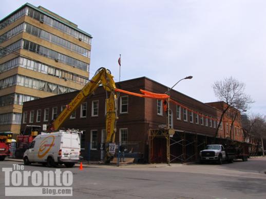
…while this photo shows how the building site appeared this past winter on February 28 2011. The two brown brick buildings on the corner site are former Children’s Aid Society of Toronto facilities that are currently being demolished
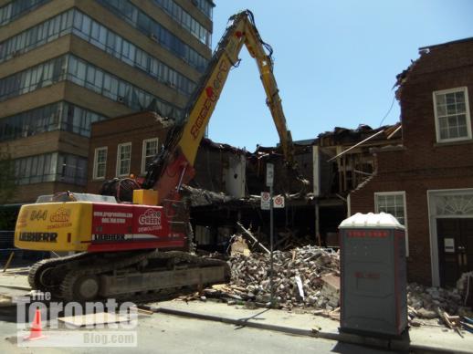
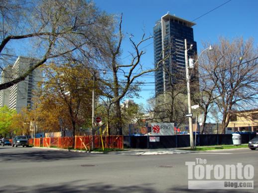
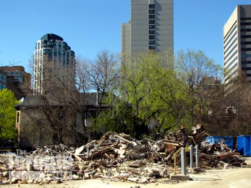
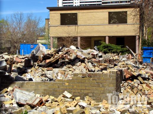
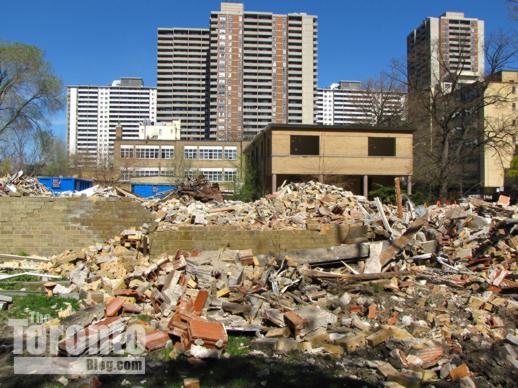
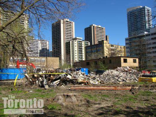
May 9 2011: This is how the site appears today, now that one of the two former CAS buildings has been reduced to a heap of rubble
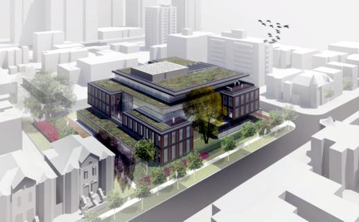
This KPMB Architects rendering depicts a northwest aerial view of the ETFO office building, showing its frontage along Huntley Street
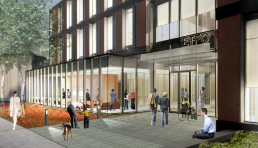
The main Isabella Street entrance to the ETFO office building is shown in this rendering provided courtesy of KPMB Architects
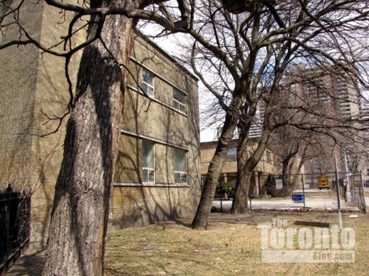
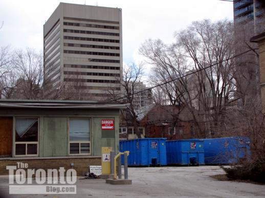
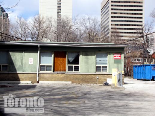
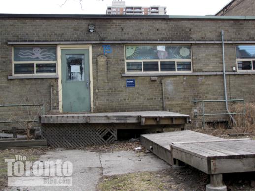
New HQ for ETFO: Residents in downtown’s Upper Jarvis area are bracing for two more years of dust, dirt, noise and increased traffic as construction gets underway on a new office building for The Elementary Teachers’ Federation of Ontario (ETFO) at the northeast corner of Huntley and Isabella Streets. The four-storey structure will be built on the 15 Huntley Street site once occupied by the Children’s Aid Society of Toronto (CAS), which five years ago moved into new offices of their own only three blocks west on Isabella.
Designed by Toronto’s KPMB Architects, the ETFO headquarters will stand four storeys tall with one level of underground parking for 50 vehicles. The building is being designed to achieve LEED (Leadership in Energy & Environmental Design) certification. It will replace a pair of 2-storey brick buildings that have been sitting vacant, and in a visible state of disrepair, since the CAS relocated to its new premises in 2006. Demolition of those structures started two weeks ago and should conclude shortly. Kael Opie, the ETFO project architect at KPMB , said construction of the new headquarters is expected to begin within the next month. Completion is anticipated for May 2013.
The Huntley-Isabella neighbourhood is bounded on three sides by busy downtown thoroughfares: Jarvis Street on the west, Bloor Street on the north, and Sherbourne Street on the east. Isabella runs east-west, linking Jarvis and Sherbourne. Earl Street and Earl Place, to its south, are quiet cul-de-sacs on the east and west sides of Huntley Street, respectively. The area is predominantly residential in character, with several highrise and lowrise apartment buildings plus numerous semidetached three-storey homes on tree-lined Selby, Linden and Huntley Streets, as well as on Earl Street and Earl Place. The area also is home to the Casey House HIV/AIDS hospice, the Isabella Hotel & Suites, the Sacré-Coeur Catholic elementary school, a campus of the Msgr. Fraser College adult learning centre, and various offices (the massive Rogers Communications head office building looms large over the neighbourhood from the northwest, while the Greenwin Square office tower, highrise apartment building and shopping centre complex do the same from their location to the north between Bloor and Selby Streets).
Like many other downtown neighbourhoods, Upper Jarvis has witnessed a flurry of condo construction during the past three years. The dust is still settling at the new James Cooper Mansion condo tower at the corner of Linden and Sherbourne Streets, where occupancy began in February and exterior landscaping is still underway. Two other condo towers — X Condos at Jarvis and Charles Street, and 500 Sherbourne just below Earl Street — both opened last spring. Two more — Couture Condos and X2 Condos — are currently under construction at Jarvis & Charles, while several more condo highrises have been proposed for nearby locations. Now, the ETFO project is tossing office construction into the neighbourhood’s mix of ongoing building activity.
Some Upper Jarvis residents are wondering what impact the 20-meter-tall ETFO building will have on their neighbourhood. Besides the usual building-period irritants of noise, dust, and movement of heavy construction vehicles and equipment, they’re concerned about a potentially substantial increase in traffic along Isabella Street, especially at evening rush hour. The entrance and exit to the employee parking garage for the gargantuan Rogers building is on Isabella, and when the place empties out at quitting time, traffic often slows to a crawl between Jarvis and Sherbourne, making it difficult for southbound motorists to turn from Huntley onto Isabella Street. Residents are still waiting to see how much extra traffic the new James Cooper Mansion condo will draw to their streets (the tower is only half occupied at this point), and fear that dozens more vehicles for ETFO staff could only worsen the situation.
For the next two years, though, one thing is certain already: they’ll definitely see a sharp increase in the number of dump trucks, concrete mixers and heavy construction vehicles driving down their streets. The ETFO held a groundbreaking ceremony at the construction site last Wednesday and, since then, demolition teams have reduced one of the two former CAS buildings to rubble. I will continue following construction of the ETFO headquarters, and will be writing a “Neighbourhood Watch” report on building activity in the neighbourhood this summer. Below is a series of photos showing the old CAS buildings on 15 Huntley Street both before and during demolition. There is also a series of photos showing buildings on Huntley and Isabella Streets that will be neighbours to the new ETFO offices.
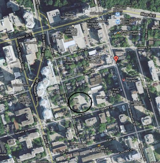
A Google map view of the Upper Jarvis area and the ETFO office site (circled)
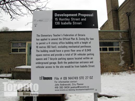
ETFO office building development proposal sign outside 15 Huntley Street
November 2 2009: Looking southeast from Huntley Street at one of the former CAS buildings on the 15 Huntley Street site for the ETFO office building
November 11 2010: Looking northeast toward 15 Huntley Street
February 16 2011: Southeast winter view of 15 Huntley Street
February 16 2011: The former CAS building at the corner of Huntley & Isabella
February 23 2011: The huge Rogers Communications head office sits at left rear; the Greenwin Square apartment and office towers on Bloor Street stand at right
February 23 2011: One of the former CAS buildings at 15 Huntley Street
February 23 2011: The second former CAS building at 15 Huntley Street. The tower at right rear is the James Cooper Mansion condo complex
February 28 2011: The former CAS buildings viewed from the southwest corner of Huntley & Isabella Streets
March 19 2011: Huntley Street view of the old CAS building, looking southeast
April 2 2011: 15 Huntley Street, looking north along Huntley from Isabella Street
April 2 2011: Looking east along Isabella Street at the two former CAS buildings
April 2 2011: Dumpsters have been delivered for the crews that will demolish the old brick buildings at 15 Huntley Street
April 2 2011: The one-storey east wing of the former CAS building at the corner of Huntley & Isabella Streets
April 2 2011: The dilapidated west side of the building at Huntley & Isabella
April 2 2011: The brick buildings have sat vacant since the CAS relocated to new headquarters on Isabella Street five years ago
April 22 2011: Security fencing has been installed around 15 Huntley Street so demolition crews can knock down the old buildings
April 22 2011: Tree protection zones have been established along Huntley Street to ensure that trees on the boulevard aren’t damaged by demolition and construction machines
April 22 2011: Looking east from Huntley Street at the tree protection zones and security fences outside 15 Huntley Street
April 22 2011: Northeast view along Huntley Street
April 22 2011: A security fence along the Huntley Street perimeter of the demolition site
April 22 2011: Looking north at the tree protection zone along Huntley Street
April 22 2011: Looking south at the tree protection zone along Huntley Street
April 22 2011: Equipment has been brought in to knock down the old buildings
April 30 2011: Demolition of 15 Huntley Street is well under way
April 30 2011: Another view of the 15 Huntley Street demolition progress
April 30 2011 The former CAS building at the corner of Huntley & Isabella is the first to be razed
April 30 2011: The east wing of 15 Huntley Street will be torn down shortly
May 4 2011: Demolition equipment on the Huntley Street side of the site
May 4 2011: The ETFO building site viewed from the top floor of an apartment building on Huntley Street
May 4 2011: An overhead view of the north half of the ETFO building site
May 4 2011: Construction crews, ETFO staff and guests begin to gather on the property for last Wednesday’s groundbreaking ceremony
May 4 2011: These trees at the north end of the property will be destroyed to make way for construction of the new ETFO office. The buildings next to the trees are semidetached private homes on Huntley and Linden Streets
May 4 2011: A demolition machine near the northeast corner of the property
May 4 2011: A demolition machine near the northeast corner of the property
May 4 2011: The north side of one building has already been ripped down
May 4 2011: Demolition progress viewed from the groundbreaking ceremony site
May 4 2011: Demolition progress viewed from the groundbreaking ceremony location, looking west toward the enormous Rogers Communications building
May 9 2011: All that’s left of one of the old CAS buildings is a large heap of rubble
May 9 2011: Looking north at the mound of rubble at 15 Huntley Street
May 9 2011: The corner building is toast; the second building goes next
May 9 2011: Looking east from Huntley Street across the demolition site
May 9 2011: Southeast view from Huntley Street across the demolition site
May 9 2011: An excavation machine has dug itself into a hole next to the rubble
March 1 2011: These charming brick homes at 37 and 35 Huntley Street sit to the immediate north of the ETFO office building construction site
March 19 2011: Brick homes on Huntley Street, between Linden Street and the EFTO building construction site
February 28 2011: The northwest corner of Huntley and Isabella Streets, directly across the street from the ETFO building site
March 1 2011: The building on the northwest corner of Huntley & Isabella is the Samuel R Wickett House, built in 1901 at 122 & 124 Isabella Street. The Rogers Communications building and X Condos tower loom large in the background
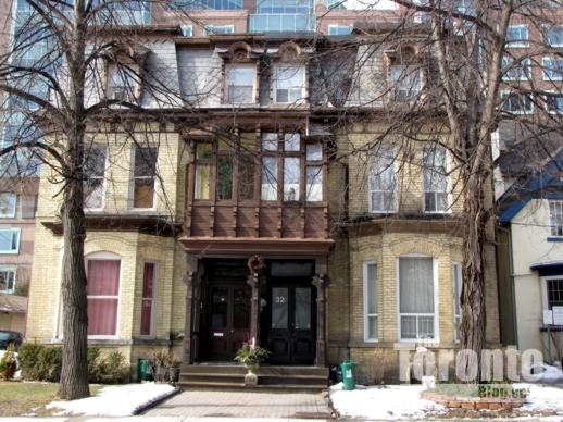
March 1 2011: The Alfred R Williams House and Francis Despard House were built in 1884 at 30 & 32 Huntley Street. Now rental apartments, they sit directly across the street from the ETFO building site
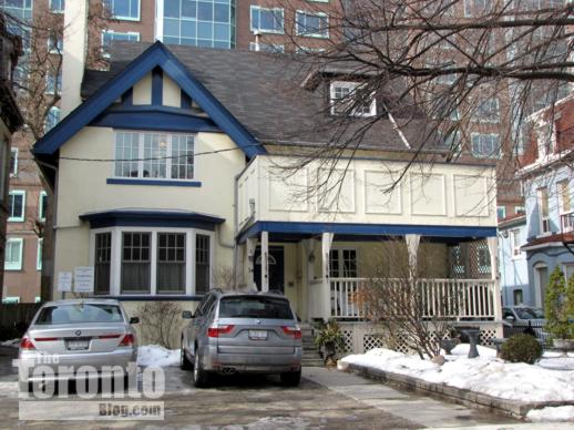
March 1 2011: The Charles E Calvert house built in 1905 at 34 Huntley Street
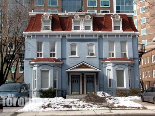
March 1 2011: The George Morphy House at 38 & 40 Huntley Street
March 21 2011: The rental apartment building at 44 Huntley Street
March 1 2011: This Coach House at 119 Isabella Street was built in 1889, and is part of the Casey House hospice. It sits on the southwest corner of Huntley & Isabella, kiddy-corner to the ETFO office building site
April 2 2011: The Casey House Hospice at 9 Huntley Street sits directly across the street from the ETFO office building site
April 2 2011: Another view of 127 Isabella Street and the Casey House Hospice at 9 Huntley Street, on the south side of the street across from the ETFO site
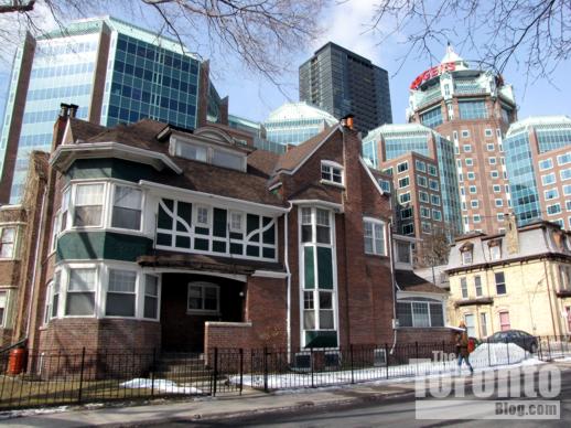
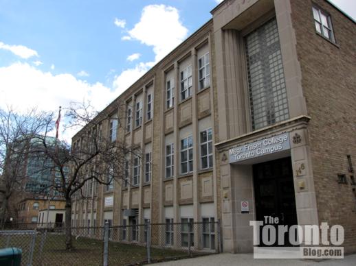
April 2 2011: The Msgr Fraser College adult learning centre will be the ETFO building’s next-door neighbour on Isabella Street
Neighbourhood Watch: Photos of Bloor-Yorkville area condos and construction activity (Part 2)
May 5 2011: The 46-storey Casa condo on Charles Street West, viewed from a driveway between the Bloor Street Neighbourhood condo (left) and the St Charles Court apartment building (right)
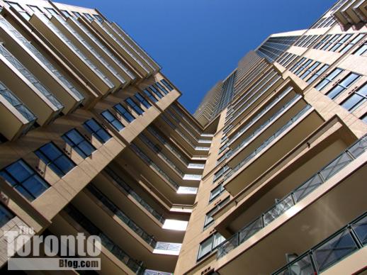
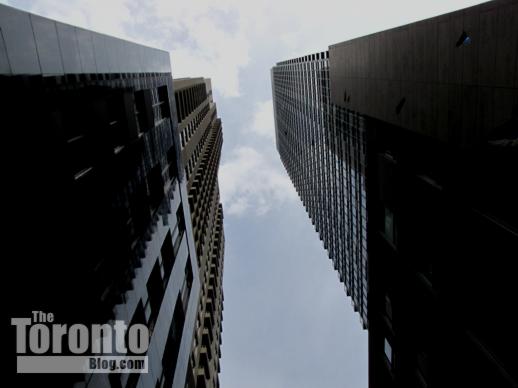
May 5 2011: looking up at the L-shaped Bloor Street Neighbourhood condo tower
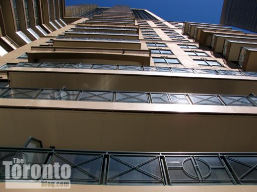
May 5 2011: Balconies on the west side of Bloor Street Neighbourhood
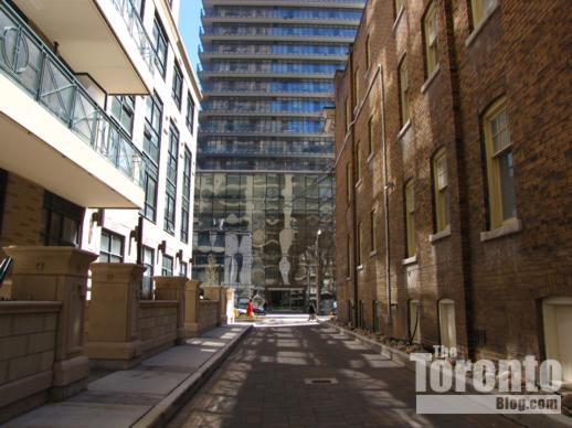
May 5 2011: South view toward the Casa condo tower from a driveway linking Hayden Street and Charles Street between the Bloor Street Neighbourhood condo tower and Charles Court apartments
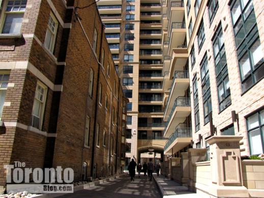
May 5 2011: Pedestrians take a short-cut north to Hayden Street along the driveway between the Charles Court apartments (left) and the Bloor Street Neighbourhood condo tower
May 6 2011: A driveway just two vehicles wide is all that separates The Uptown Residences (left) and Crystal Blu Condos, new condo towers on Balmuto Street
May 6 2011: Construction on the exterior of The Uptown Residences is complete — except for the condo tower’s main entrance on Balmuto Street
May 6 2011: Construction of the Four Seasons Toronto Hotel + Residences, viewed from outside The Uptown Residences
May 6 2011: Four Seasons Toronto Hotel + Residences viewed from Balmuto Street
April 30 2011: Four Seasons Toronto Hotel + Residences tower viewed from the northwest corner of Bloor and St Thomas Streets
May 5 2011: Four Seasons Hotel + Residences Toronto construction viewed from Church Street near Park Road
April 23 2011: Looking south at the excavation progress for the Milan condo tower under construction at Yonge & Church
April 23 2011: View toward the southeast corner of the Milan condo tower excavation site, from the Canadian Tire store parking lot next door
April 23 2011: Deep excavation in the site’s southeast corner on Church Street
April 23 2011: Excavation activity near the Yonge subway line at the north side of the Milan condo tower construction site
April 23 2011: The Milan condo tower excavation entrance ramp off Church Street
May 5 2011: A view of the Milan excavation from the site’s southeast corner on Church Street, as a subway train passes the east side of the construction area.
May 5 2011: Church Street view through security fencing toward the northeast corner of the Milan condo tower construction site
May 5 2011: Looking north from Church Street toward the Canadian Tire store next to the Milan condo construction zone
May 5 2011: view toward the east side of the Milan site from the Church Street construction entrance ramp
May 5 2011: Church Street view of the Milan site, looking northeast
April 30 2011: Construction progress at the Seventy Seven Charles West condos viewed from Charles Street
April 30 2011: Seventy Seven Charles West condos viewed from the corner of St Thomas and Charles Streets
April 30 2011: Looking south on St Thomas Street at the Seventy Seven Charles West condos
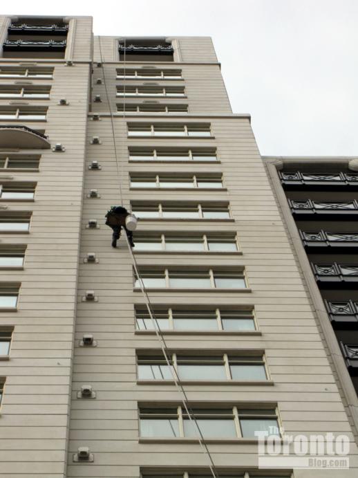
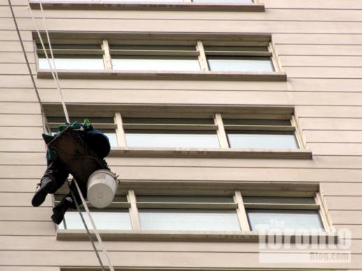
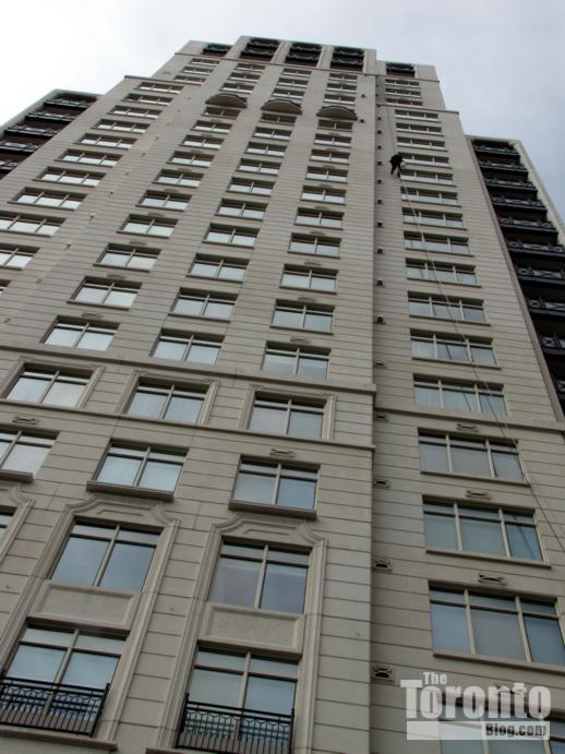
April 22 2011: A window washer descends the south side of the 29-storey One St Thomas condo tower, which sits directly across Charles Street from the Seventy Seven Charles west condo construction site
April 22 2011: The cleaner works his way down the limestone-clad wall
April 22 2011: His job perk is a view inside some of the city’s most exclusive luxury condos
April 22 2011: The tower, which evokes highrise buildings from 1920s and 1930s-era New York City, was designed by Robert A.M. Stern Architects
May 6 2011: Hoarding is installed along St Nicholas Street and heavy machinery positioned on St Mary Street as crews prepare to demolish buildings where the Nicholas Residences condo tower will be constructed
May 6 2011: This building was formerly home to Regis College, the Jesuit Graduate Faculty of Theology at the University of Toronto. The interior has been gutted, and demolition of the brick exterior is imminent
May 6 2011: Nicholas will rise 35 storeys next to the Church of Scientology Toronto building, left, at the corner of Yonge & St Mary Streets
April 30 2011: Bay Street view of excavation progress at the U Condos construction site, looking northwest toward hoarding along St Mary Street. The construction crane for the Seventy Seven Charles West condo building rises behind Loretto College, the 6-storey brick building toward the upper left of the photo.
April 30 2011: Looking from Bay Street toward excavation machinery at the northwest corner of the U Condos construction site
April 30 2011: A shoring machine on the U Condos construction site
April 30 2011 A steel I-beam sunk into the ground to help shore up the huge U Condos site for excavation and foundation construction
April 30 2011: Southward view from St Mary Street of excavation progress on the U Condos construction site
April 30 2011 St Mary Street view toward the southeast corner of the U Condos construction site
April 30 2011 St Mary Street view toward the southwest corner of the U Condos construction site
April 30 2011 St Mary Street view toward the southwest corner of the U Condos construction site
April 30 2011: A shoring machine in the SW corner of the U Condos site
St Mike’s opens research, healthcare centres at new Li Ka Shing Knowledge Institute building
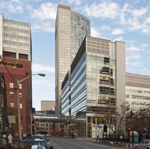
West view from along Shuter Street of the Li Ka Shing Knowledge Institute (right) and the tubular pedestrian bridge linking it to St. Michael’s Hospital. Photo courtesy of Elizabeth Gyde/Diamond and Schmitt Architects.
Centre celebration: St Michael’s Hospital yesterday celebrated the official opening of its new Keenan Research Centre and Li Ka Shing International Healthcare Education Centre — facilities collectively known as the Li Ka Shing Knowledge Institute. The hospital says the Centres “are among the first in the world — and the only ones in Toronto — specifically designed to bring together researchers, educators and clinicians to brainstorm ideas across professions and to take best practices and research discoveries to patient bedsides faster.”
The Keenan Research Centre occupies 25,200 square metres (271,300 square feet) with three floors of flexible, open concept wet laboratories and two floors for dry lab study in a wide range of medical research programs. 400 research staff will work there. The building’s education component includes a library, classroom and meeting facilities. These are linked by multi-level lounges that sit above Victoria Lane and are connected by an elegant wishbone staircase, providing a focal point for informal encounters. A 200-seat raked auditorium also serves as a conference centre and lecture hall.
The nine-storey building was designed by Jack Diamond, a principal with Toronto’s Diamond and Schmitt Architects. It occupies the north side of Shuter Street between Victoria and Bond Streets, and is connected to St Michael’s Hospital by a 21-meter tubular glass pedestrian bridge.
A Diamond and Schmitt press release says design highlights of the Li Ka Shing Knowledge Institute building “include a glass curtainwall, which allows natural light to penetrate deep into the building. This serves not only to create an open and engaging workspace but also a visibly accessible connection into the world of medical research for the community at large. Solar shading placed horizontally on the south façade and vertically on the west façade minimizes heat gain and is made of glass instead of the typical metal shades so as not to impede the views to landmark buildings such as St. Michael’s Cathedral and Massey Hall. Other sustainable features include energy recovery systems on air handling units, reflective roofing, light sensors and a high use of recycled content in materials.”


