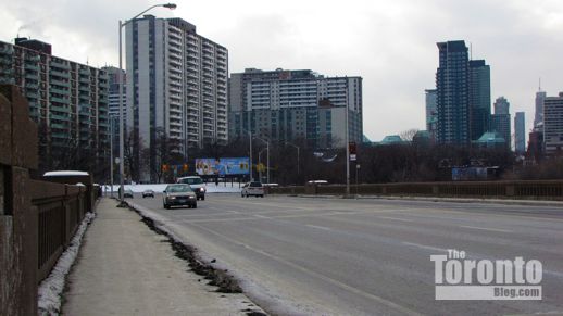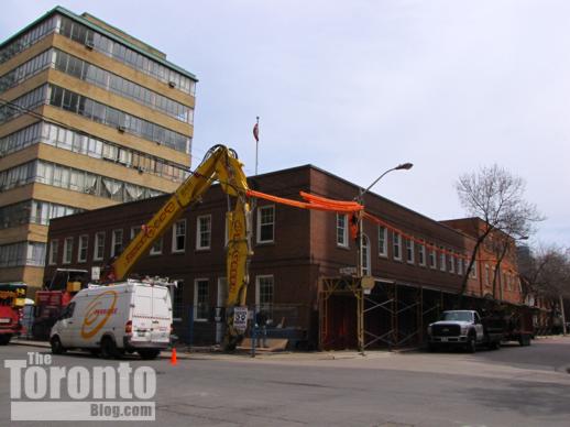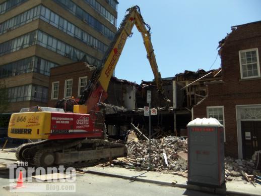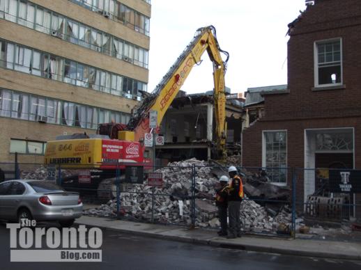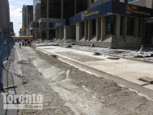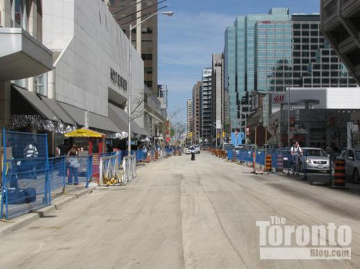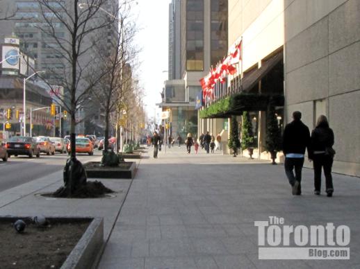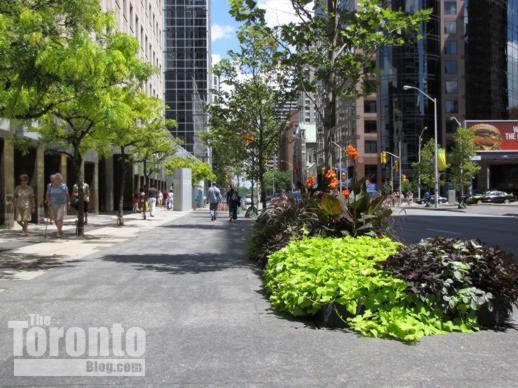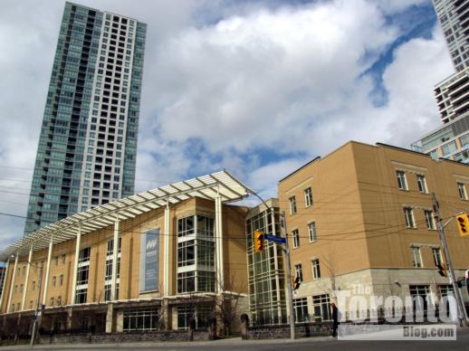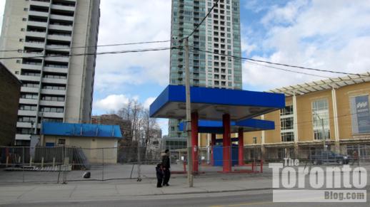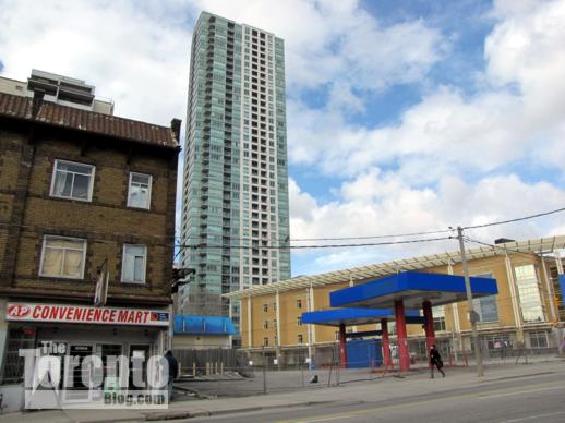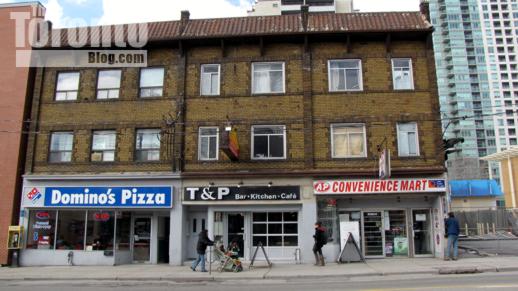
Category Archives: Neighbourhoods and Streetscapes

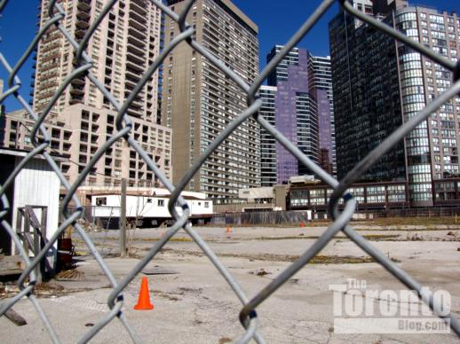
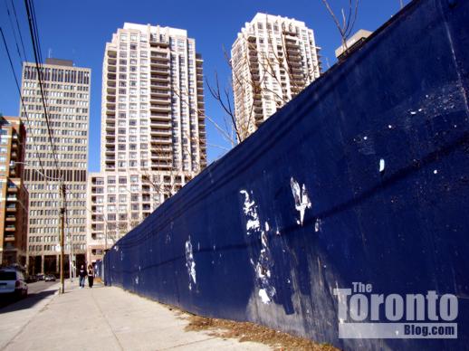
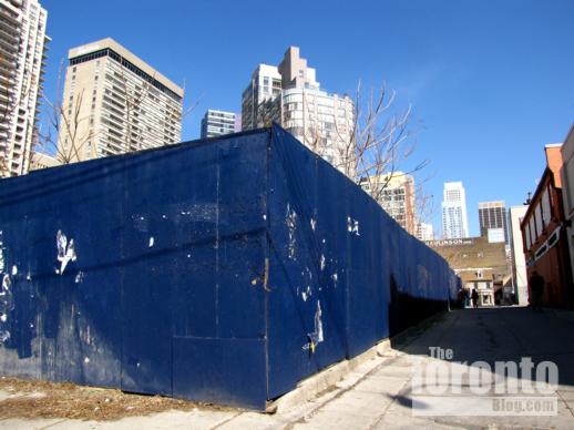
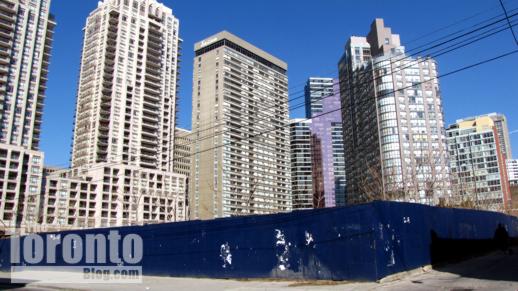
Condo tower building sites squeezing traffic on construction-weary Charles Street East

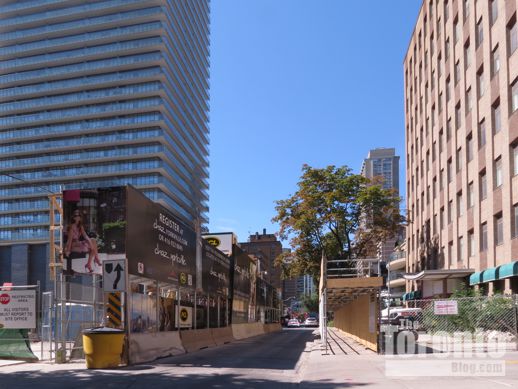
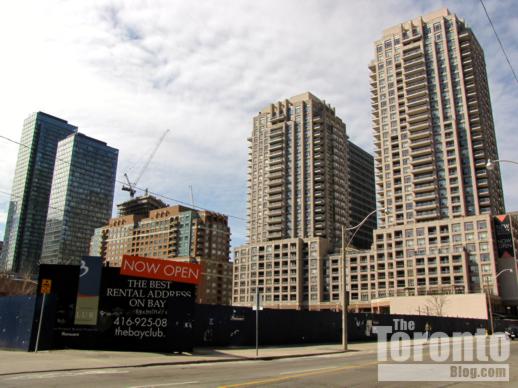
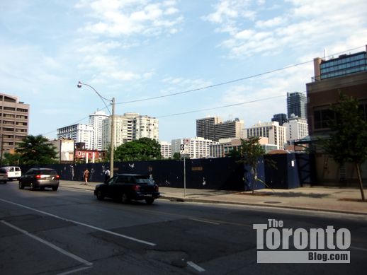
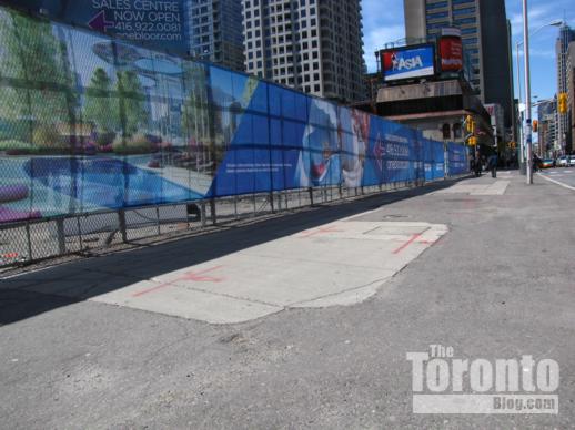
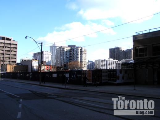
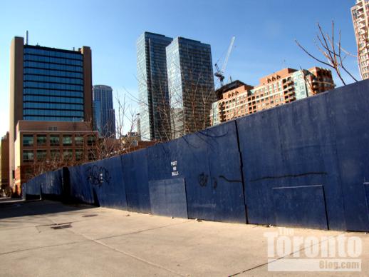
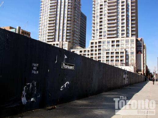
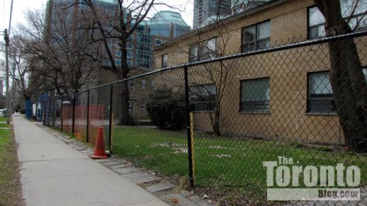
Construction hoarding outside 42 & 45 Charles Street East  Toronto

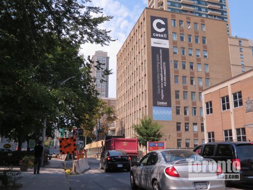
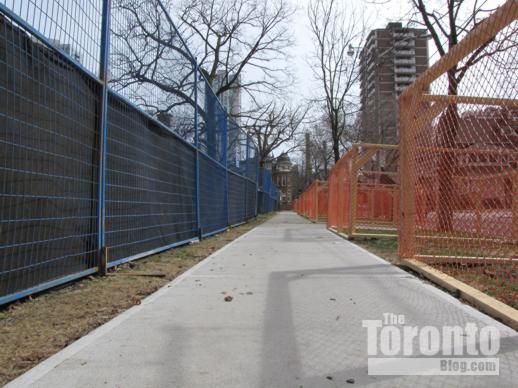
September 1 2012 : One-way Charles Street squeezes into a single narrow lane while hoarding and security fences cramp the already-narrow sidewalks along the facing condo construction sites for ChazYorkville, left, and Casa 2 right


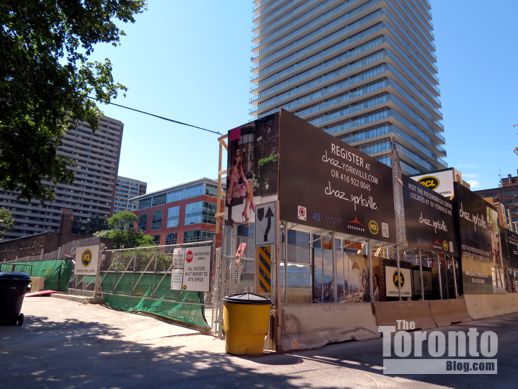
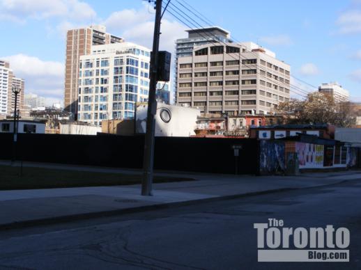
45 Charles Street East Toronto

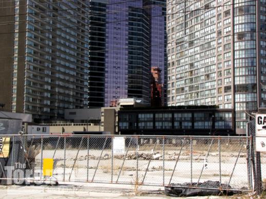
September 1 2012: Hoarding has surrounded the ChazYorkville site at 45 Charles East since last fall, when demolition started on a 45-year-old, 8-storey Modernist-style office building that formerly occupied the property  …


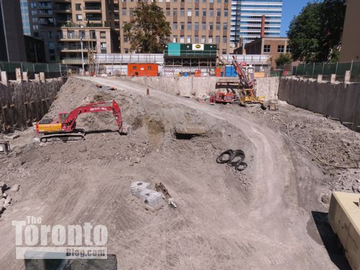
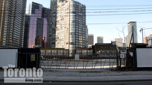
ChazYorkville condo tower excavation

… now the site of a large excavation that gets deeper each day


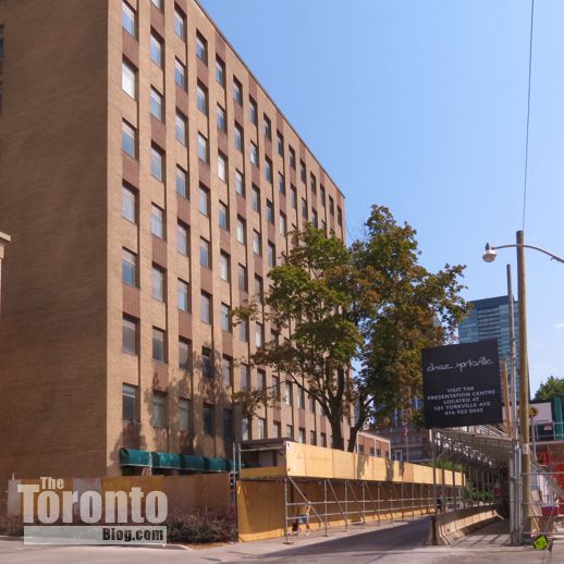
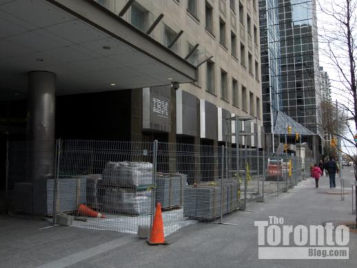
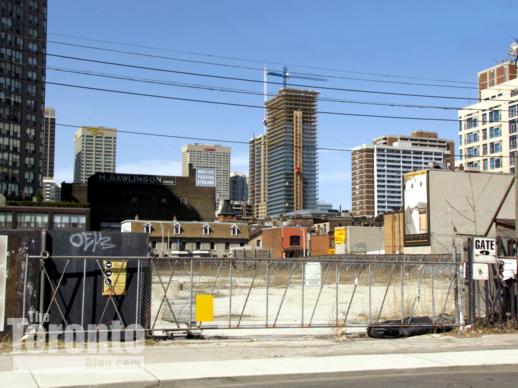
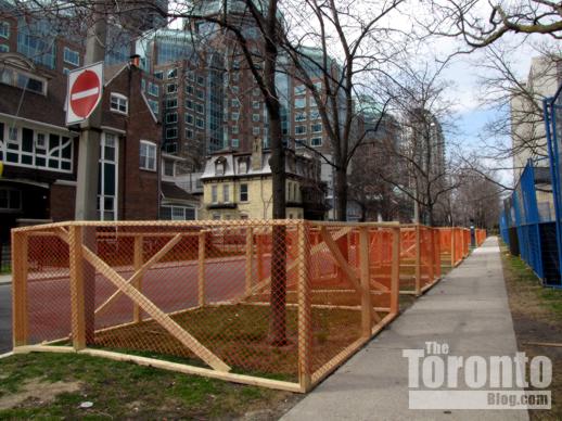
 42 Charles Street East Toronto

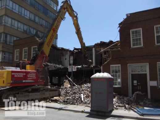
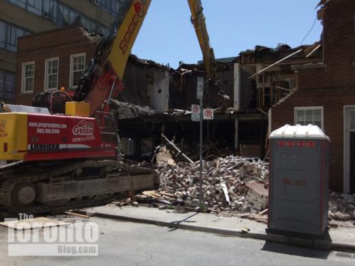
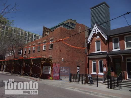
August 31 2012: Hoarding was installed on the north sidewalk, along the front of the office building at 42 Charles, in late August …


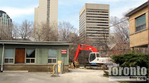
42 Charles Street East Toronto

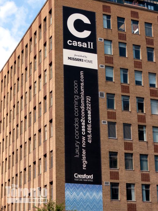
… where the 9-storey brick building, once administrative offices for the YMCA, will be demolished to make room for the 56-storey Casa 2 Condominiums


Near 42 and 45 Charles Street East Toronto

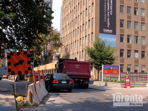
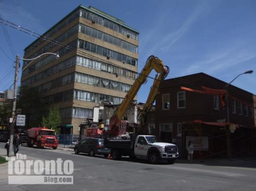
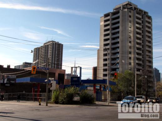
August 31 2012: Cars try to squeeze past a dump truck waiting its turn to enter the ChazYorkville site and pick up a load of soil from the excavation


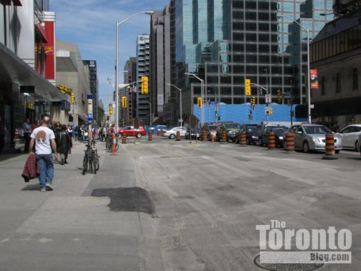
Charles Street East Toronto

August 31 2012: Motorists and pedestrians alike will face disruption and traffic congestion on this block of Charles Street for at least the next three to four years …


Charles Street postal station February 26 2012

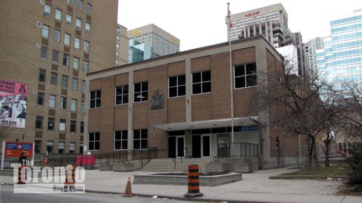
… and possibly much longer, if Canada Post sells Postal Station F at 50 Charles East, right next door to the Casa 2 site, for residential highrise redevelopment


Tight squeeze: Residents on and near the block of Charles Street between Church & Yonge Streets have reluctantly resigned themselves to at least four more years of dirt, dust, noise and traffic congestion, courtesy of two condo tower construction sites practically within whispering distance of each other on opposite sides of the street.

Construction of the 47-storey ChazYorkville condo tower commenced last fall when demolition crews destroyed a Modernist-style office building that had occupied 45 Charles for more than four decades. Foundation shoring and drilling work started in the spring, and excavation activity has been underway since May. 

The same process is set to repeat itself directly across the street where hoarding was installed in late August along the public sidewalk in front of 42 Charles. Demolition of the 9-storey brick office building that presently stands on the site will start this fall, followed by shoring and excavation for the 56-floor Casa 2 Condominiums tower.


CONTINUED ON PAGE 2

Highrise condo cluster could threaten character of leafy low-rise street near Yonge & Wellesley

Dundonald Street Toronto

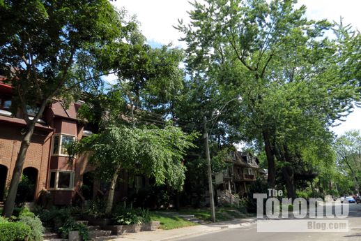
The lush trees and gardens adorning the front yards of these brick homes on the north side of Dundonald Street could be imperiled by construction of up to four condo highrises …


17 Dundonald Street Toronto

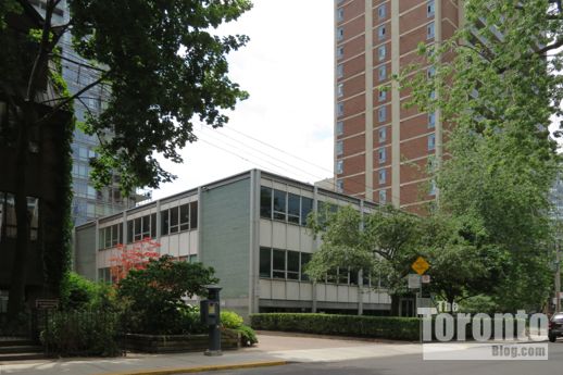
… including an 18-storey tower that would incorporate parts of the brick, travertine and glass facade of this Modern-style office building constructed in 1956 at 17 Dundonald …


31-37 Dundonald Street Toronto

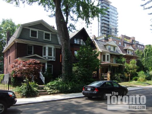
… a potential 18-storey condo on the site of these three-storey houses at 31-37 Dundonald, currently being offered for sale as a block for redevelopment …


22, 40 and 50 Wellesley Street East Toronto

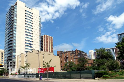
… and two more condo towers, each at least 28 storeys tall, that would loom above Dundonald Street from this location on Wellesley Street East to the immediate south ….


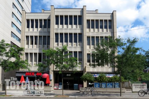
40 Wellesley Street East Toronto

… including a 118-meter-tall (32 storeys) condo tower that a developer wishes to build on the site of this 5-storey office building at 40 Wellesley Street East …


50 Wellesley Street East condo site

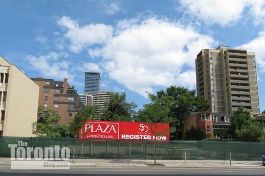
… and a 28-storey condo, now being marketed to prospective purchasers, on the site of what is currently an empty lot at 46-50 Wellesley Street East


Dundonald doomed?: A quiet, tree-lined residential street in north downtown’s Church-Wellesley neighbourhood could lose much of its appeal, charm and character — and possibly even much of its lush greenery — if proposals for four condo towers in the area come to fruition.

Only one block long, Dundonald Street runs east-west between Yonge and Church Streets, just one block north of Wellesley Street. It’s among my favourite downtown streets, one I walk several times each week to avoid the noise, steady vehicular traffic and busy sidewalks of Wellesley Street. But my alternative walking route might lose its quiet, pleasant appeal in several years’ time if two highrise condo buildings get built on the south side of Dundonald, along with two more right behind them on the north side of Wellesley Street.


CONTINUED ON PAGE 2

Wellesley Street site touted as potential new park now listed for sale for highrise redevelopment

11 Wellesley Street potential city park site

The 11 Wellesley Street West site, viewed from the northeast last year …


11 Wellesley Street West Toronto

… and viewed today from the northwest on Wellesley Street near Bay Street


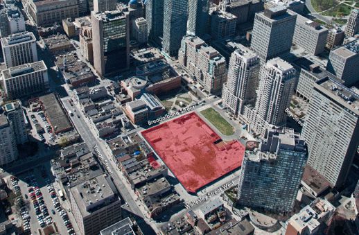
CBRE Limited website illustration of the Bay & Wellesley lands

This image, from a flyer on the CBRE Limited website,  shows an aerial view of the property now listed for sale for redevelopment


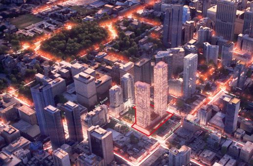
CBRE Limited website illustration of the Bay & Wellesley lands

This illustration, also from the CBRE Limited online flyer, suggests the highrise development potential for the 2-acre Ontario Government property


Park plans deep-sixed?: Downtown residents who were hoping a new public park would be created on provincial government property that has sat vacant near Yonge & Wellesley for years will be dismayed to learn that the land has instead been listed for sale for potential highrise redevelopment. Nevertheless, a city councillor plans to seek City Council approval to direct municipal real estate officials to negotiate acquisition of the property “for parkland purposes.”

A commercial real estate advertisement in today’s Globe and Mail newspaper touts the 2-acre “East of Bay” lands at 11 Wellesley Street West as a “downtown Toronto development opportunity.” The ad, published by real estate brokerage CBRE Limited, says the land “is located in a prime downtown residential development corridor,” and is “centrally positioned” between the city’s financial core and its tony Bloor-Yorkville district.


CONTINUED ON PAGE 2

Planners studying revised design for mixed-use highrise complex proposed for King & Spadina

 401 King Street West

This artistic illustration, provided courtesy of Core Architects Inc., shows the 2-tower condo, retail and office development now being proposed for the southeast corner of King Street and Spadina Avenue …


401 King West  original redevelopment proposal rendering

… in place of the single 39-story tower complex originally proposed for the site, depicted in this rendering provided by Core Architects Inc.


401 King Street West heritage building

The facade of this 6-storey listed heritage building at 401 King Street West …

<>

401 King Street West

will still, as in the original plan, be incorporated into the new complex, as depicted in this rendering from Core Architects Inc.


401 King West condo development site

The new complex of two towers – rising 21 and 37 storeys, respectively, on an 8- to 11-storey podium – will totally transform the corner site, currently occupied by the 6-floor heritage-listed brick building and a 1-level liquor store.


New proposal: Will a condo, retail and office complex with two highrise residential buildings better suit the King & Spadina neighbourhood than a project with only one tower? That’s one of the questions that city planners will be grappling with as they assess a revised development proposal for a property on the southeast corner of the busy King-Spadina intersection.

The site, most of which is occupied by a 1-storey liquor store constructed in 2009 at 415 King West, could clearly handle highrise redevelopment. But it’s the shape, size and density of any new structure to be built there that has been a sticking point with city planners, the local councillor and area residents.


CONTINUED ON PAGE 2

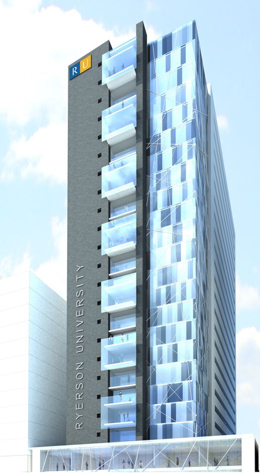
Ryerson University unveils plans to build 500-bed student highrise residence near Jarvis & Dundas

new Ryerson student residence

An artistic illustration by IBI Group Architects of the student residence  Ryerson University plans to build in the Jarvis-Dundas area


186-188 Jarvis Street Toronto

February 28 2012: Looking west at the 186-188 Jarvis Street site on which Ryerson University will build its new student accommodations


New student digs: A new 500-bed residence planned for the Jarvis & Dundas area will help Ryerson University meet burgeoning demand for student accommodation while bringing more liveliness and energy to a downtown streetscape that could clearly use some enhancement.

The residence — to be built on what is currently a pay parking lot at 186-188 Jarvis Street — is expected to feature a 2-storey podium containing cafés and retail outlets topped by “a 20+ storey building offering a mix of 1, 2, 3 and 4 bedroom units,” the university announced in a media release.


CONTINUED ON PAGE 2

The skyline and CityPlace on a sunny winter day

Downtown Toronto skyline

Toronto growing taller

<>

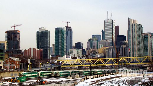
A view of the downtown Toronto skyline, looking east from the Bathurst Street Bridge this afternoon. The cityscape boasts three new skyscrapers, including Charlie Condos at King & Charlotte Streets (with crane, at left) Living Shangri-La Toronto at University Avenue & Adelaide Street (with crane, center rear), and the Trump International Hotel + Tower Toronto, partly visible to the left side of First Canadian Place. The Trump Toronto Hotel opened for business today.


CN Tower and CityPlace skyscrapers

CN Tower, CityPlace and the Puente de Luz bridge


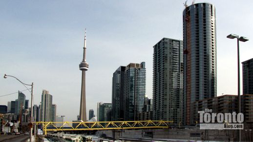
A Bathurst Street bridge view of the CN Tower, some of the condo skyscrapers at Concord CityPlace, and the yellow Puente de Luz bridge which will connect City Place to Front Street West above the railway tracks. Below are videoclips I shot this afternoon showing the downtown skyline, construction activity at the Library District condominiums complex at the west end of CityPlace, and the various condo highrises at CityPlace. The latter clip includes views of the grey-and-white, 41-storey Toronto Community Housing apartment tower under construction at 150 Dan Leckie Way, as well as close-ups of the points where a 2-level bridge will link the round and rectangular Parade condo towers.


<>

<>

<>

<>

<>

<>

Public gets opportunity to weigh in tonight on controversial condo tower plan for 501 Yonge

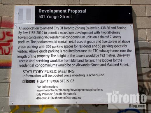
501 Yonge Street condo development proposal sign

One of the development proposal signs that has been posted on each side of the 501 block of Yonge Street since last spring


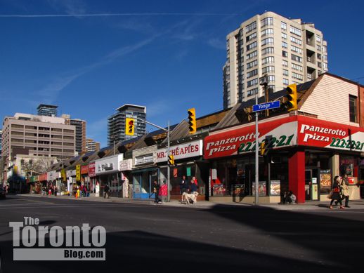
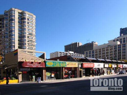
501 Yonge Street proposed condo tower site

November 6 2011: The 501 Yonge Street block seen from the southwest


501 Yonge Street proposed condo tower site

November 6 2011: The 501 Yonge Street block viewed from the northwest


Glass wall: Toronto residents get their chance tonight to tell city planners what they think of a controversial proposal to build two 58-storey condo point towers atop a 7-storey rectangular glass podium on the east side of Yonge Street, between Alexander and Maitland Streets.

The community consultation is the second meeting city officials scheduled for this week to get public input on a major condo tower development plan by Lanterra Developments, a 10-year-old Canadian company that boasts sales of more than 6,000 condo units in downtown Toronto.

At the first, held two nights ago, Lanterra and architect Peter Clewes of Toronto’s architectsAlliance were on the hot seat during a community consultation over Lanterra’s ambitious plans for a massive 4-tower condo complex that would revitalize three blocks of long-neglected property along Bloor and Howard Streets in North St James Town. During that meeting (which I’m planning to report soon in TheTorontoBlog), at least 30 people stood up to speak their mind with overwhelmingly negative comments and observations.  Tonight, city planners and Lanterra’s team face Toronto residents again at a session that many people expect will be equally raucous and critical.

Tonight’s community consultation was requested by Toronto and East York Community Council, one of four groups of city councillors that make recommendations and decisions about local planning and development, as well as neighbourhood-specific issues within their jurisdiction. The session will give city residents an opportunity to review, ask questions about and express their opinions on Lanterra’s application to redevelop the low-rise 501 block of Yonge Street with a condo project that is vastly taller and denser than present zoning bylaws permit.

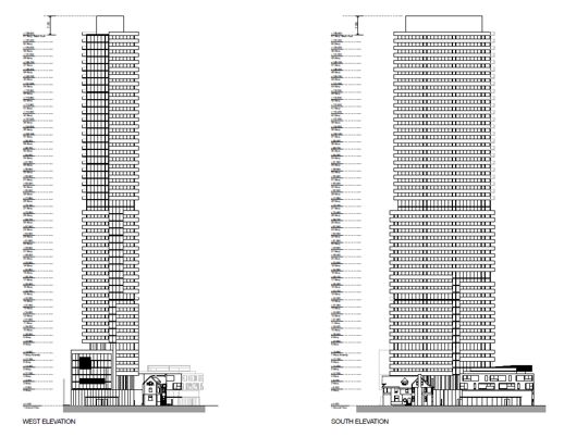
As noted in a May 30 2011 background report by city planners, Lanterra wants to build two 58-storey residential towers that would rise from one 7-storey podium. The podium would include two levels of retail space with five floors of parking above them (parking must be built above grade because the Yonge subway line runs diagonally beneath the entire 501 Yonge site). Each tower would contain 480 condo units and have its own lobby entrance; the north tower’s would be off Maitland Street, while the south tower lobby would be accessed from Alexander Street. The towers would soar 192 meters (including mechanical penthouse) and would be constructed in two phases, with the podium and south tower being built first.

Under current zoning regulations for the 501 Yonge site, the maximum permitted density is 3 times the lot area, with 2 times the lot area for commercial uses and 3 times the lot area for residential uses,” the city planners’ report notes. “The maximum height permitted is 18 metres.” However, Lanterra’s proposed condo complex would be 20 times the permitted density, with the height “significantly” exceeding what is presently allowed.

The size and height of the project horrifies many area residents, who fear that the podium’s enormous glass wall and the soaring towers above it will ruin the historic low-rise character of north Yonge Street (the section between College and Bloor Streets), destroy the pedestrian ambience on the street, and wreck what they consider to be “gateways” to the nearby Church-Wellesley Village neighbourhood — the tree-shaded outdoor dining and bar patios on the Alexander and Maitland ends of the block.

The consultation starts at 6.30 pm in the 2nd-floor auditorium at the Grosvenor Street YMCA.

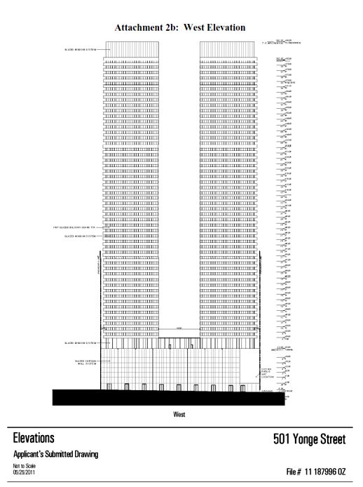
Below are drawings, from the city planners’ report, that show the proposed elevations for the 501 Yonge complex, along with some photos and a video I have taken of the project site. 


501 Yonge west elevation drawing

This illustration, from city planning documents, depicts a west elevation for the proposed two-tower complex


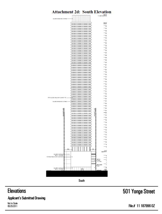
501 Yonge south elevation drawing

From the city planners’ report, this drawing depicts a south elevation for the rectangular 7-storey podium and 58-storey point towers


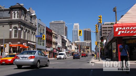
Yonge Street viewed from Alexander Street

 A view of Yonge Street looking north from Alexander Street on June 30 2011. Many neighbourhood residents fear the Lanterra project would overwhelm and destroy the historic low-rise character of Yonge Street.


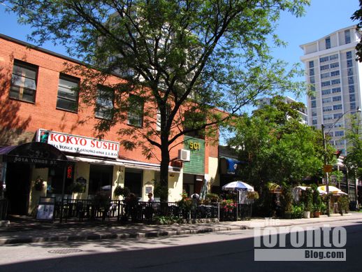
The tree-shaded outdoor patios for Kokyo Sushi and Pi-Tom’s Thai Restaurant on Alexander Street would be replaced with the south tower’s lobby.


SE corner of Yonge & Maitland Toronto

Two more patios would be lost at the north end of the block …


La Cocina Lucero patio at 501 Yonge Street Toronto

… including the Cocina Lucero restaurant patio at the corner of Yonge & Maitland …


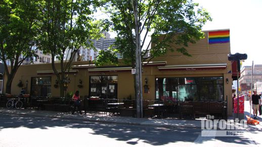
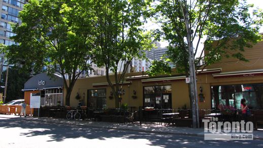
Lola and Cocina Lucero patios on Maitland Street Toronto

… and the terrace for Lo’La martini bar to the east, at the corner of Maitland Street and Maitland Terrace


xx

xx
xx

4-tower condo proposal for North St James Town faces 2nd public feedback meeting tonight

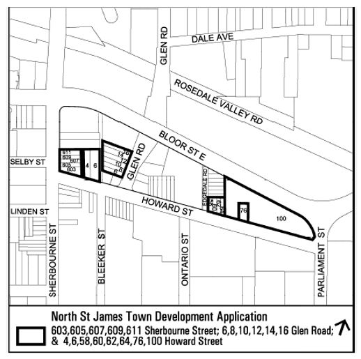
North St James Town proposed condo development site

From a City of Toronto planning department background report, this illustration outlines the various parcels of land that Lanterra Developments is proposing to redevelop into a condo complex featuring four tall towers


Feedback forum: A daring proposal to dramatically redevelop the scruffy North St James Town neighbourhood with four new condo skyscrapers, several low-rise buildings and seven restored heritage houses is headed for a showdown with the public tonight at a community consultation meeting being held by Toronto’s City Planning Division.

The meeting, the second to be held this year, will give the public an opportunity to hear revised plans for the massive condo  project that Lanterra Developments has proposed for three blocks of a long wedge-shaped area bounded by Bloor, Parliament, Howard and Sherbourne Streets. In a rezoning application filed with the City on August 25 2010, Lanterra outlined bold development plans that would revitalize three separate blocks of land at the northern perimeter of the St James Town district with four towers designed by Peter Clewes of Toronto’s architectsAlliance.


Block 1: Northeast corner of Sherbourne and Howard Streets

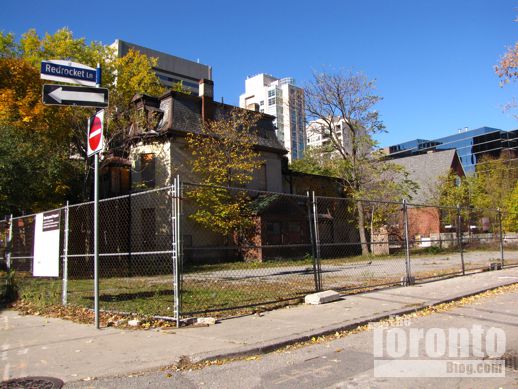
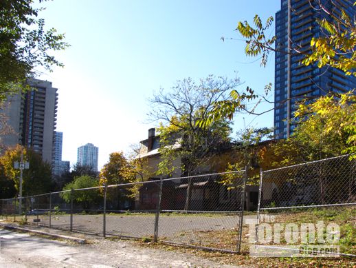
For this area, the developer proposed a 390-unit condo complex featuring a 50-storey tower, 7-storey podium and 5 levels of underground parking with 288 spaces. The tower would rise next to the Anson Jones House, a Queen Anne-style heritage building designed by Edmund Burke that sits on the corner of Sherbourne and Howard at 603 Sherbourne. The podium would include retail space along Sherbourne Street, while a 3-story mixed use building located along Howard Street would be linked to the complex. The plan would require the demolition of three heritage properties: two semidetached houses at 605 and 607 Sherbourne, next to the Anson House, along with a standalone house at 4 Howard Street. Vehicular access to the complex would be off Red Rocket Lane, which runs north-south between Howard and Bloor Streets one block east of Sherbourne.


Block 2: Glen Road between Howard and Bloor Streets

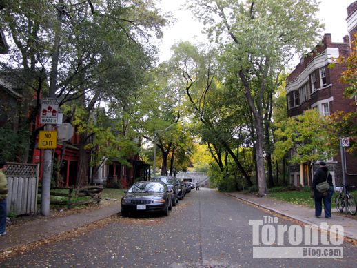
The west side of this leafy one-block-long section of Glen Road is noteworthy for six semidetached brick houses which have been boarded and bricked up for decades. Under Lanterra’s proposal, these homes would be restored for residential use, though rear portions of the buildings would be demolished to allow for construction of a 5-storey apartment building with 41 units along with 15 above-ground parking spots and 17 below-ground spaces.


Block 3: From Edgedale Road to Parliament Street

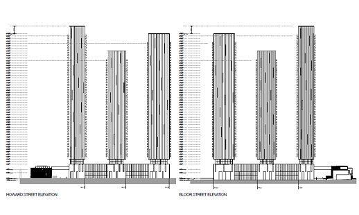
This long stretch of land between Howard and Bloor Streets would feature three condo towers on the eastern end of the property along with a 2-storey amenity and service building at the site’s southwest corner at Edgedale and Howard. The west tower would be 56 storeys tall with 630 units; the middle tower would be 46 floors with 425 units, and the east tower would rise 53 stories and contain 348 units. The complex would have 5 levels of underground parking with 869 spaces. A heritage building at 76 Howard Street would have to be demolished to make way for the three skyscrapers.


Public consultation and working group meetings

In a December 8 2010 background report, city planners said they could not support Lanterra’s proposal “in its current form.” They wrote: “Of considerable concern to staff is the appropriateness of the proposed land use redesignation, along with the proposal’s significant scale, density, massing and transition towards the existing adjacent Neighbourhoods in the centre of the North St. James Town neighbourhood and Apartment Neighbourhoods to the south, as well as the provision of open space.” They also identified 26 specific planning issues that would have to be considered and addressed before they could give their blessing to the condo plan.

As mentioned previously, city planners then held a public community consultation session to gather feedback about Lanterra’s proposal. The first meeting, attended by more than 150 people on April 5, drew sharp and overwhelmingly negative criticism from the audience, which objected to the proposed project’s height and density in particular, as well as to the impact that 1,840 new condo units could have on the heavily-populated low-income St James Town neighbourhood to the south.

The proposal was subsequently considered during an April 19 meeting of the city’s Design Review Panel, and during a series of working group meetings that city planners organized between neighbourhood representatives, professional advisors for the developer, and staff from the city’s planning and transportation departments. (Draft minutes from the meetings held on May 24, May 31, June 7 and October 5 can be viewed online at the links provided from the community group-run Smart Development in North St James Town website.)

Tonight’s meeting, from 7 to 9 pm at St Simon-the-Apostle Anglican Church on Bloor Street, is being held to update the public on the status of the rezoning application, and give the community a change to review and ask questions about revised project plans.

Below are some of my photos showing how the three development sites currently look, along with three videoclips showing each of the three blocks proposed for development and revitalization. (Note: The photo captions describe the original development proposal, not the revised plans which will be unveiled at tonight’s meeting.)


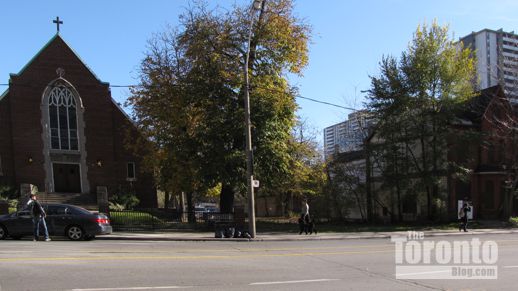
Trinity Evangelical Lutheran Church Sherbourne Street

The 50-storey tower proposed for Block 1 would rise to the right of Trinity Evangelical Lutheran Church on Sherbourne Street


607 605 and 603 Sherbourne Street  Toronto

From left: 607, 605 and 603 Sherbourne Street. The two buildings on the left would be demolished and only the corner building, the Anson Jones House, would be kept and incorporated into the new tower project.


607 and 605 Sherbourne Street Toronto

607 and 605 Sherbourne Street, which would be destroyed to make room for the proposed 50-storey condo tower


603 Sherbourne Street Toronto

The Anson Jones House at 603 Sherbourne Street, which would be restored and incorporated into the condo development


603 Sherbourne Street Toronto

The Anson Jones House at 603 Sherbourne viewed from Howard Street


4 Howard Street Toronto

This heritage building at 4 Howard Street would be demolished and replaced with a 3-storey mixed-use building


4 Howard Street Toronto

The east side of 4 Howard Street, viewed from Red Rocket Lane


Bleecker Street view of site for proposed 50 storey condo

Looking northwest from Bleecker Street to the site for which a 50-storey condo tower had been proposed. The Filipono food store building visible at right is not part of the redevelopment plan.


site for proposed 50 storey condo tower

The proposed tower site is less than a minute’s walking distance from Bloor Street and the Sherbourne subway station


Red Rocket Lane Toronto

Another view of the site, off Red Rocket Lane, where the developer has proposed building a 50-storey tower


southeast view down Red Rocket Lane

Southeasterly view down Red Rocket Lane of the site for the proposed tower


architectsAlliance illustration of Block 1 tower elevations

This architectsAlliance illustration of the proposed 50-storey tower for Sherbourne & Howard appears in documents filed with the city planning department


North view of Glen Road Toronto

Looking north along Glen Road. The six semidetached houses that would be restored sit on the left side of the street.


6, 8, 10, 12, 14 and 16 Glen Road

The houses that would be restored at 6, 8, 10, 12, 14 and 16 Glen Road


the rear of 6, 8, 10, 12, 14 and 16 Glen Road

A view of the rear of the houses at 6, 8, 10, 12, 14 and 16 Glen Road


6, 8, 10, 12, 14 and 16 Glen Road

The proposal called for part of the back of these buildings to be demolished. A 5-storey apartment building would be constructed in the area behind the houses, along with above- and below-ground parking.


Glen Road viewed from Bloor Street

Bloor Street view of Glen Road, looking south toward Howard Street


architectsAlliance illustration of Block 3 tower elevations

This architectsAlliance illustration of the Block 3 tower elevations appears in application documents filed with city planners. These towers would stand between Edgedale Road at the west and Parliament Street to the east.


Edgedale Road Toronto

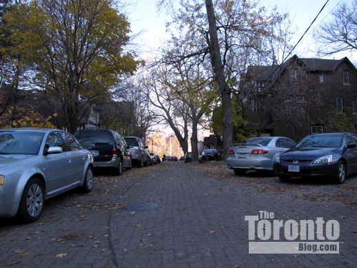
Edgedale Road, looking north from Howard Street toward Bloor Street


property along Howard Street near Edgedale Road

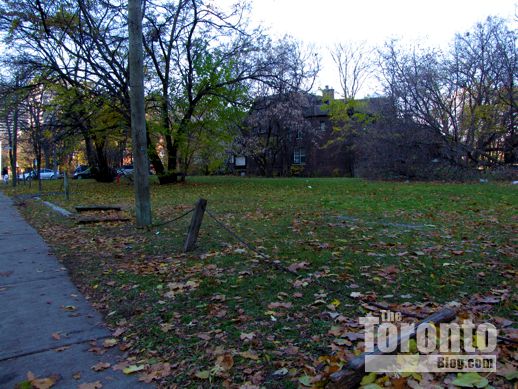
Looking west along Howard Street toward Edgedale Road. The amenities and service building for the towers would be situated near this spot.


illustration of west view along Howard Street

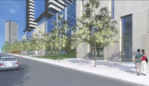
This illustration, from a planning rationale report filed with the city planning department by Bousfields Inc., shows how the view west along Howard Street could appear once the towers are constructed


76 Howard Street Toronto

This house at 76 Howard Street was built in 1887. It sits near the middle of the proposed site for the three towers, and would have to be demolished to permit construction.


76 Howard Street Toronto

Bloor Street view of the heritage house at 76 Howard Street


looking east along Bloor Street toward 76 Howard Street

A view of the 3-tower site, looking east along Bloor Street toward Parliament Street from behind the house at 76 Howard.


looking east toward Bloor & Parliament intersection

Looking east toward the Bloor-Parliament intersection, from the field next to 76 Howard Street.Two of the towers would be built here.


view toward Bloor Street from the field next to 76 Howard

View toward Bloor Street and the Rosedale ravine from the field next to 76 Howard Street


Looking west along Howard Street from Parliament Street

West view from Parliament Street of the development site along Howard Street


west view across the site for 3 proposed towers

The property between Parliament Street and 76 Howard Street currently is home to trees, a grassy lawn, billboards and dozens of squirrels


Bloor Parliament intersection

Looking west toward the development site from the Bloor-Parliament intersection


Bloor Street view toward downtown Toronto

Looking west along Bloor Street from the sidewalk opposite the Castle Frank subway station. If built, the four condo towers would dominate this view.


xx

xx

xx

xx

xx

Crews razing former Jesuit college to prepare site for Nicholas Residences condo construction

Nicholas Residences condo tower construction site

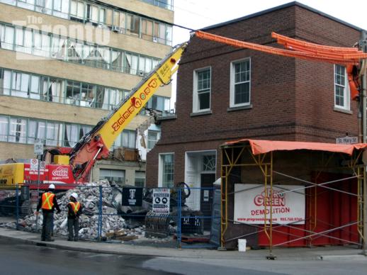
May 6 2011: Hoarding is up and a demolition machine has been positioned to prepare for demolition of the former Regis College buildings.


Nicholas Residences condo tower construction site

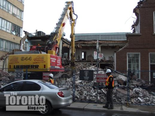
May 9 2011: Crews have pulled down roughly one-third of the building


Nicholas Residences condo construction site

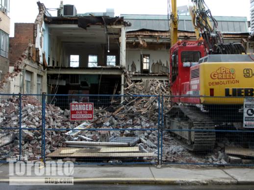
May 11 2011: Almost half of the structure has now been reduced to rubble


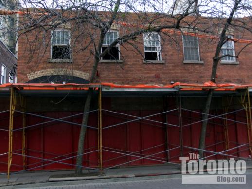
Tumbling down: The brick building that once housed Regis College, the Jesuit Graduate Faculty of Theology at the University of Toronto, is almost gone.  During the past two days, demolition crews have knocked down nearly half of the building at the southeast corner of St Nicholas and St Mary Streets. They’re expected to finish smashing down the rest of the brick walls by the weekend. Once the structure is cleared from the site, construction can commence on the 35-storey Nicholas Residences condo tower. Below are photos of this week’s demolition activity; to view pictures of the former Regis College buildings before the wrecking crews arrived, check out my May 7 2011 Neighbourhood Watch post, as well as my more detailed March 31 2011 post about the Nicholas Residences project.


Nicholas Residences condo tower construction site

May 9 2011: Demolition crew smashes down the building’s north facade on St Mary Street, next to the Church of Scientology Toronto building


Nicholas Residences condo tower construction site

May 9 2011: The ground floor was reinforced so the demolition machine can drive into the middle of the building and knock out the east, south and west walls.


Nicholas Residences condo construction site

May 11 2011: Most of the northeast corner section of the building had been destroyed by the time the demolition crews went to lunch today.


Nicholas Residences condo construction site

May 11 2011: Most of the third floor has been removed from the former college building at 67 St Nicholas Street, which was built as a planing mill in the 1880s. The facade is supposed to be rebuilt as part of the condo complex.


Nicholas Residences condo construction site

May 11 2011 Hoarding protects the sidewalk outside 67 St Nicholas Street where the third floor has already been demolished


Nicholas Residences condo construction site

May 11 2011: The northeast third of the building has been razed


Nicholas Residences condo construction site

May 11 2011: Almost all of the St Nicholas Street facade has been knocked down


Nicholas Residences condo construction site

May 11 2011: The inside of the building was gutted during March and April


Nicholas Residences condo construction site

May 11 2011: This structure should be rubble by the weekend


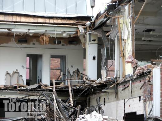
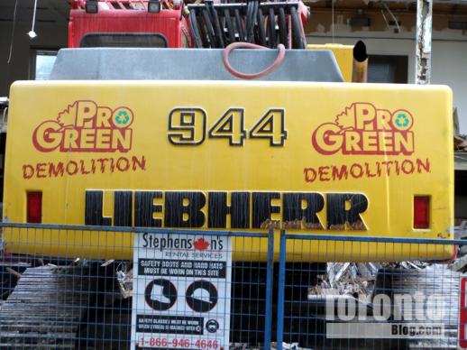
Nicholas Residences condo construction site

May 11 2011: The Liebherr R 944 C Litronic is a multipurpose excavating machine. Here, its purpose is to destroy the old Regis College building.


Demolition clearing way for construction to start on 4-storey office building at Huntley & Isabella

KPMB Architects rendering of ETFO office building

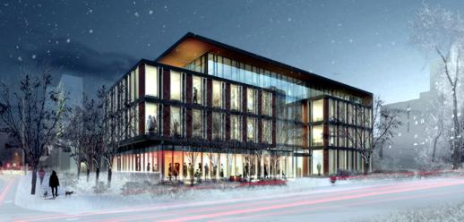
This rendering, provided courtesy of KPMB Architects in Toronto, illustrates a southwest winter view of the new offices to be built at Huntley & Isabella Streets for The Elementary Teachers’ Federation of Ontario (ETFO) …

15 Huntley Street site for new ETFO office building

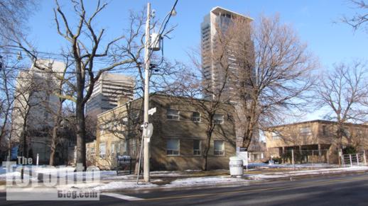
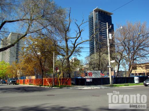
…while this photo shows how the building site appeared this past winter on February 28 2011. The two brown brick buildings on the corner site are former Children’s Aid Society of Toronto facilities that are currently being demolished
 

Demolition of 15 Huntley Street

May 9 2011: This is how the site appears today, now that one of the two former CAS buildings has been reduced to a heap of rubble
 

KPMB Architects rendering of new ETFO office building

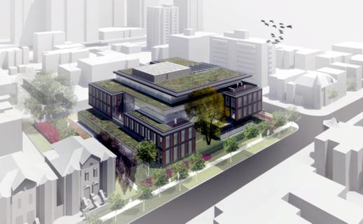
This KPMB Architects rendering depicts a northwest aerial view of the ETFO office building, showing its frontage along Huntley Street
 

KPMB Architects rendering of new ETFO office building entrance

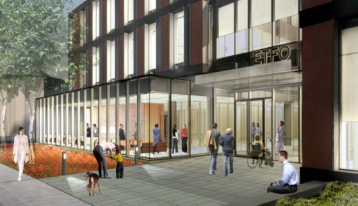
The main Isabella Street entrance to the ETFO office building is shown in this rendering provided courtesy of KPMB Architects


New HQ for ETFO: Residents in downtown’s Upper Jarvis area are bracing for two more years of dust, dirt, noise and increased traffic as construction gets underway on a new office building for The Elementary Teachers’ Federation of Ontario (ETFO) at the northeast corner of Huntley and Isabella Streets. The four-storey structure will be built on the 15 Huntley Street site once occupied by the Children’s Aid Society of Toronto (CAS), which five years ago moved into new offices of their own only three blocks west on Isabella.

Designed by Toronto’s KPMB Architects, the ETFO headquarters will stand four storeys tall with one level of underground parking for 50 vehicles.  The building is being designed to achieve LEED (Leadership in Energy & Environmental Design) certification. It will replace a pair of 2-storey brick buildings that have been sitting vacant, and in a visible state of disrepair, since the CAS relocated to its new premises in 2006. Demolition of those structures started two weeks ago and should conclude shortly. Kael Opie, the ETFO project architect at KPMB , said construction of the new headquarters  is expected to begin within the next month. Completion is anticipated for May 2013.

The Huntley-Isabella neighbourhood is bounded on three sides by busy downtown thoroughfares: Jarvis Street on the west, Bloor Street on the north, and Sherbourne Street on the east. Isabella runs east-west, linking Jarvis and Sherbourne. Earl Street and Earl Place, to its south, are quiet cul-de-sacs on the east and west sides of Huntley Street, respectively.  The area is predominantly residential in character, with several highrise and lowrise apartment buildings plus numerous semidetached three-storey homes on tree-lined Selby, Linden and Huntley Streets, as well as on Earl Street and Earl Place. The area also is home to the Casey House HIV/AIDS hospice, the Isabella Hotel & Suites, the Sacré-Coeur Catholic elementary school, a campus of the Msgr. Fraser College adult learning centre, and various offices (the massive Rogers Communications head office building looms large over the neighbourhood from the northwest, while the Greenwin Square office tower, highrise apartment building and shopping centre complex do the same from their location to the north between Bloor and Selby Streets).

Like many other downtown neighbourhoods, Upper Jarvis has witnessed a flurry of condo construction during the past three years. The dust is still settling at the new James Cooper Mansion condo tower at the corner of Linden and Sherbourne Streets, where occupancy began in February and exterior landscaping is still underway. Two other condo towers — X Condos at Jarvis and Charles Street, and 500 Sherbourne just below Earl Street — both opened last spring. Two more — Couture Condos and X2 Condos — are currently under construction at Jarvis & Charles, while several more condo highrises have been proposed for nearby locations. Now, the ETFO project is tossing office construction into the neighbourhood’s mix of ongoing building activity.

Some Upper Jarvis residents are wondering what impact the 20-meter-tall ETFO building will have on their neighbourhood. Besides the usual building-period irritants of noise, dust, and movement of heavy construction vehicles and equipment, they’re concerned about a potentially substantial increase in traffic along Isabella Street, especially at evening rush hour. The entrance and exit to the employee parking garage for the gargantuan Rogers building is on Isabella, and when the place empties out at quitting time, traffic often slows to a crawl between Jarvis and Sherbourne, making it difficult for southbound motorists to turn from Huntley onto Isabella Street. Residents are still waiting to see how much extra traffic the new James Cooper Mansion condo will draw to their streets (the tower is only half occupied at this point), and fear that dozens more vehicles for ETFO staff could only worsen the situation.

For the next two years, though, one thing is certain already: they’ll definitely see a sharp increase in the number of dump trucks, concrete mixers and heavy construction vehicles driving down their streets. The ETFO held a groundbreaking ceremony at the construction site last Wednesday and, since then, demolition teams have reduced one of the two former CAS buildings to rubble. I will continue following construction of the ETFO headquarters, and will be writing a “Neighbourhood Watch” report on building activity in the neighbourhood this summer. Below is a series of photos showing the old CAS buildings on 15 Huntley Street both before and during demolition. There is also a series of photos showing buildings on Huntley and Isabella Streets that will be neighbours to the new ETFO offices.
 

Google map view of the Upper Jarvis area

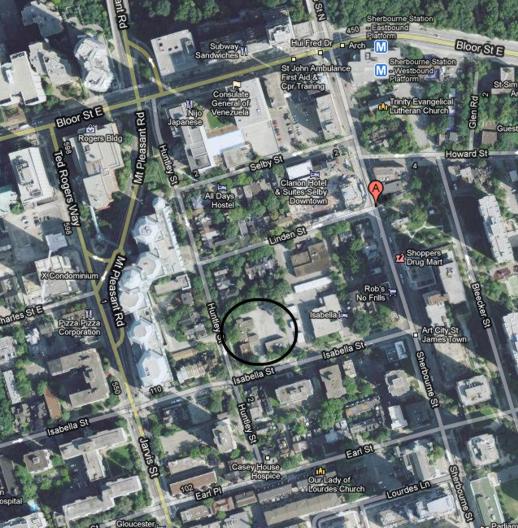
A Google map view of the Upper Jarvis area and the ETFO office site (circled)
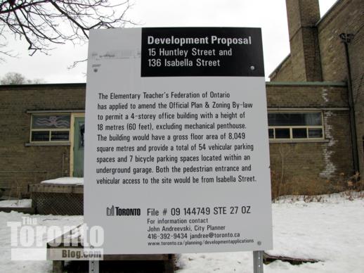
 

ETFO office building development proposal sign

ETFO office building development proposal sign outside 15 Huntley Street
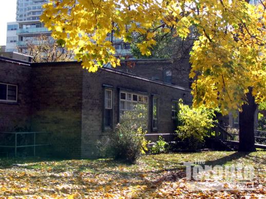
 

15 Huntley Street on November 2 2009

November 2 2009: Looking southeast from Huntley Street at one of the former CAS buildings on the 15 Huntley Street site for the ETFO office building
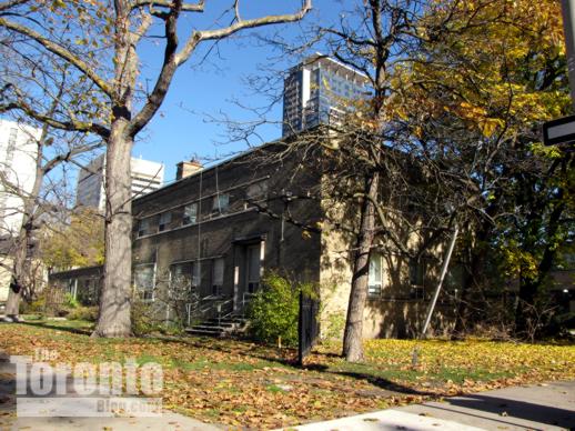
 

15 Huntley Street on November 11 2010

November 11 2010: Looking northeast toward 15 Huntley Street
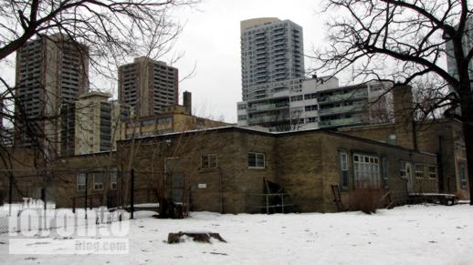
 

15 Huntley Street on February 16 2011

February 16 2011: Southeast winter view of 15 Huntley Street
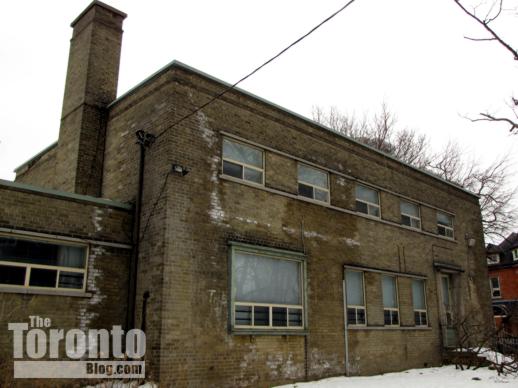
 

15 Huntley Street on February 16 2011

February 16 2011: The former CAS building at the corner of Huntley & Isabella
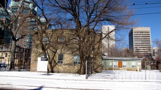
 

15 Huntley Street on February 23 2011

February 23 2011: The huge Rogers Communications head office sits at left rear; the Greenwin Square apartment and office towers on Bloor Street stand at right
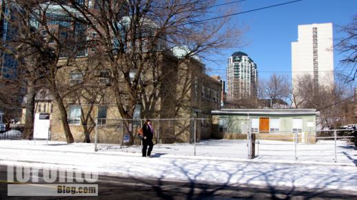
 

15 Huntley Street on February 23 2011

February 23 2011: One of the former CAS buildings at 15 Huntley Street
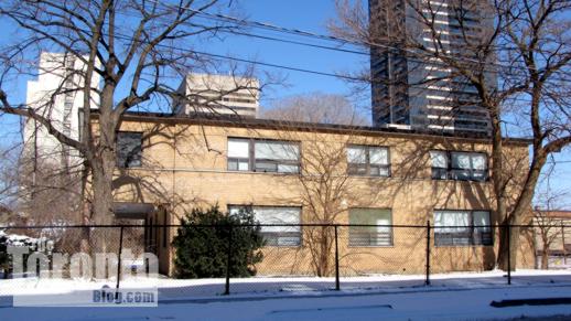
 

15 Huntley Street on February 23 2011

February 23 2011: The second former CAS building at 15 Huntley Street. The tower at right rear is the James Cooper Mansion condo complex
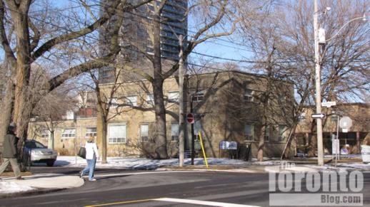
 

The northeast corner of Huntley & Isabella Streets

February 28 2011: The former CAS buildings viewed from the southwest corner of Huntley & Isabella Streets
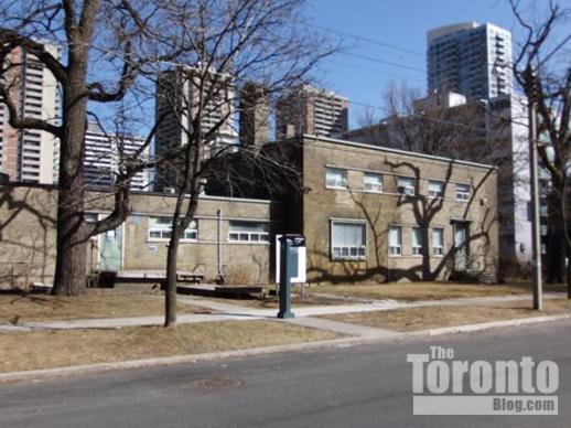
 

15 Huntley Street on March 19 2011

March 19 2011: Huntley Street view of the old CAS building, looking southeast
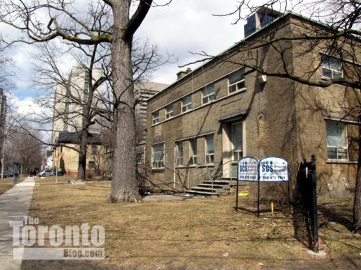
 

15 Huntley Street

April 2 2011: 15 Huntley Street, looking north along Huntley from Isabella Street
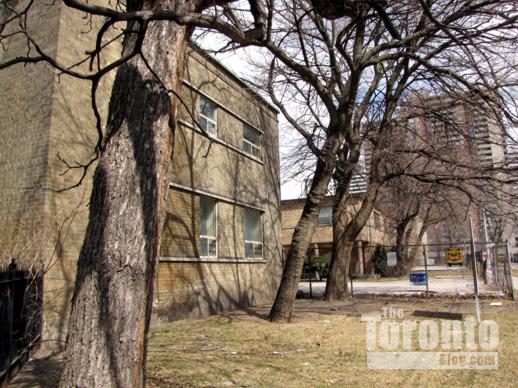
 

15 Huntley Street

April 2 2011: Looking east along Isabella Street at the two former CAS buildings
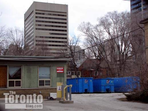
 

15 Huntley Street

April 2 2011: Dumpsters have been delivered for the crews that will demolish the old brick buildings at 15 Huntley Street
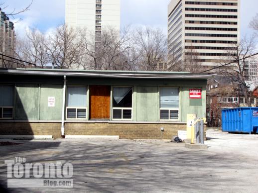
 

15 Huntley Street

April 2 2011: The one-storey east wing of the former CAS building at the corner of Huntley & Isabella Streets
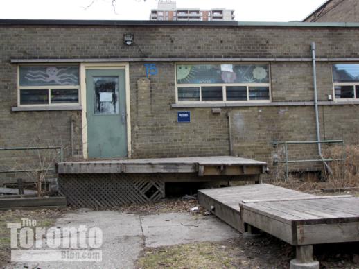
 

15 Huntley Street

April 2 2011: The dilapidated west side of the building at Huntley & Isabella
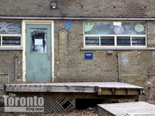
 

15 Huntley Street

April 2 2011: The brick buildings have sat vacant since the CAS relocated to new headquarters on Isabella Street five years ago
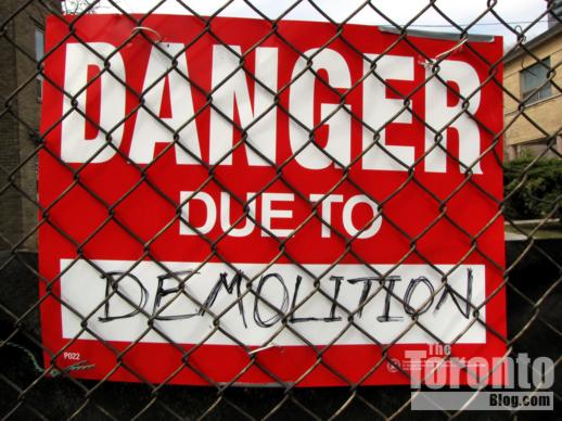
 

demolition danger warning sign

April 22 2011: Security fencing has been installed around 15 Huntley Street so demolition crews can knock down the old buildings
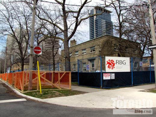
 

15 Huntley Street

April 22 2011: Tree protection zones have been established along Huntley Street to ensure that trees on the boulevard aren’t damaged by demolition and construction machines
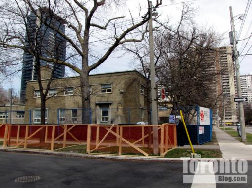
 

 tree protection zones outside 15 Huntley Street

April 22 2011: Looking east from Huntley Street at the tree protection zones and security fences outside 15 Huntley Street
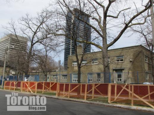
 

Tree protection zones outside 15 Huntley Stree

April 22 2011: Northeast view along Huntley Street
 

fencing around 15 Huntley Street

April 22 2011: A security fence along the Huntley Street perimeter of the demolition site
 

a tree protection zone along Huntley Street
April 22 2011: Looking north at the tree protection zone along Huntley Street
 

Tree protection zones outside 15 Huntley Street

April 22 2011: Looking south at the tree protection zone along Huntley Street


demolition equipment at 15 Huntley Street

April 22 2011: Equipment has been brought in to knock down the old buildings
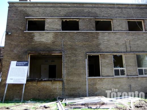
 

15 Huntley Street demolition

April 30 2011: Demolition of 15 Huntley Street is well under way
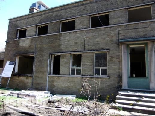
 

15 Huntley Street demolition

April 30 2011: Another view of the 15 Huntley Street demolition progress
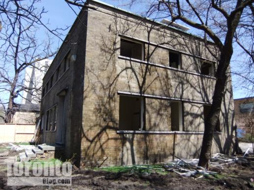
 

15 Huntley Street demolition

April 30 2011 The former CAS building at the corner of Huntley & Isabella is the first to be razed
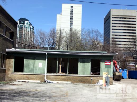
 

15 Huntley Street demolition

April 30 2011: The east wing of 15 Huntley Street will be torn down shortly
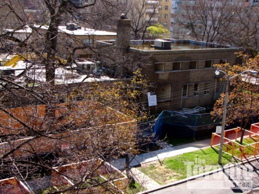
 

15 Huntley Street

May 4 2011: Demolition equipment on the Huntley Street side of the site
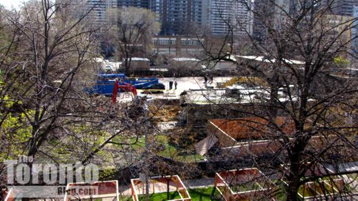
 

15 Huntley Street

May 4 2011: The ETFO building site viewed from the top floor of an apartment building on Huntley Street
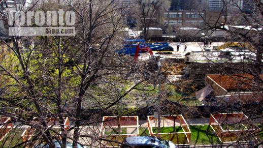
 

15 Huntley Street

May 4 2011: An overhead view of the north half of the ETFO building site
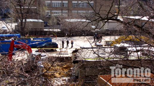
 

15 Huntley Street

May 4 2011: Construction crews, ETFO staff and guests begin to gather on the property for last Wednesday’s groundbreaking ceremony
 

15 Huntley Street

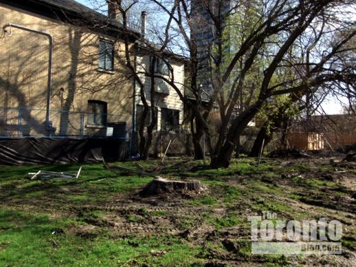
May 4 2011: These trees at the north end of the property will be destroyed to make way for construction of the new ETFO office. The buildings next to the trees are semidetached private homes on Huntley and Linden Streets
 

15 Huntley Street

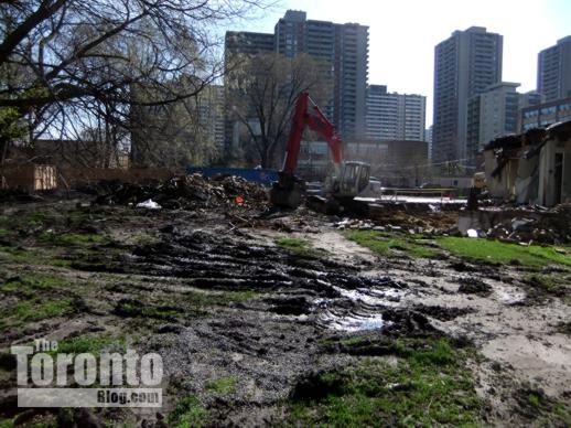
May 4 2011: A demolition machine near the northeast corner of the property
 

15 Huntley Street

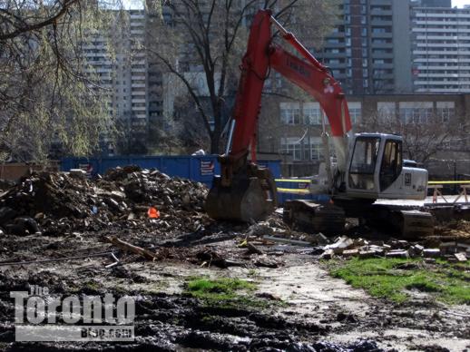
May 4 2011: A demolition machine near the northeast corner of the property
 

15 Huntley Street demolition

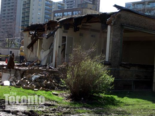
May 4 2011: The north side of one building has already been ripped down
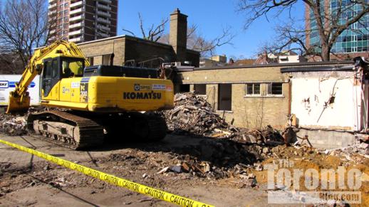
 

15 Huntley Street demolition progress

May 4 2011: Demolition progress viewed from the groundbreaking ceremony site
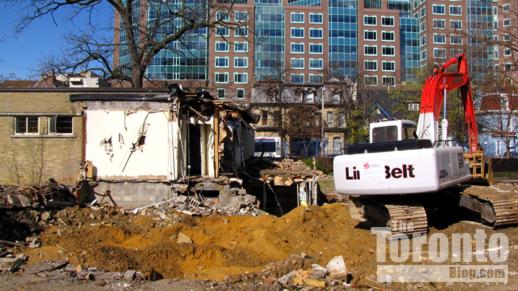
 

15 Huntley Street demolition progress

May 4 2011: Demolition progress viewed from the groundbreaking ceremony location, looking west toward the enormous Rogers Communications building
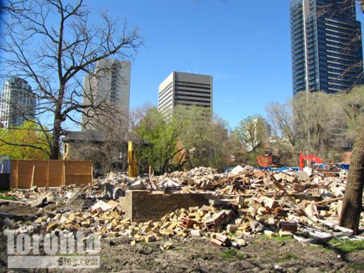
 

15 Huntley Street building demolition

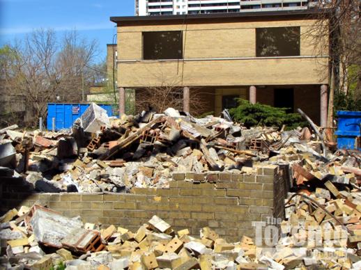
May 9 2011: All that’s left of one of the old CAS buildings is a large heap of rubble
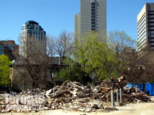
 

15 Huntley Street building demolition

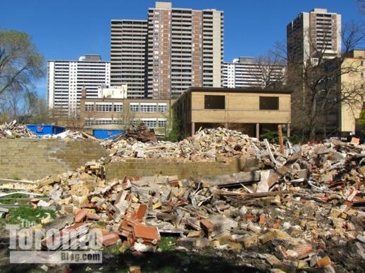
May 9 2011: Looking north at the mound of rubble at 15 Huntley Street
 

15 Huntley Street building demolition

May 9 2011: The corner building is toast; the second building goes next
 

15 Huntley Street building demolition

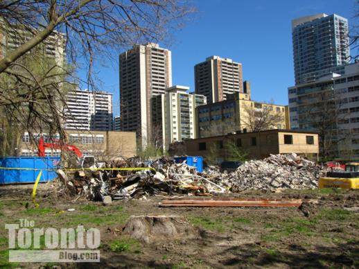
May 9 2011: Looking east from Huntley Street across the demolition site
 

15 Huntley Street building demolition

May 9 2011: Southeast view from Huntley Street across the demolition site
 

15 Huntley Street building demolition

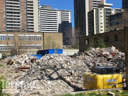
May 9 2011: An excavation machine has dug itself into a hole next to the rubble
 

37 & 35 Huntley Street

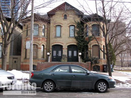
March 1 2011: These charming brick homes at 37 and 35 Huntley Street sit to the immediate north of the ETFO office building construction site
 

Brick houses on Huntley Street

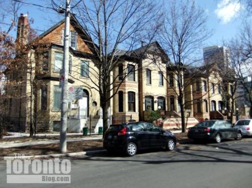
March 19 2011: Brick homes on Huntley Street, between Linden Street and the EFTO building construction site
 

The northwest corner of Huntley and Isabella Streets

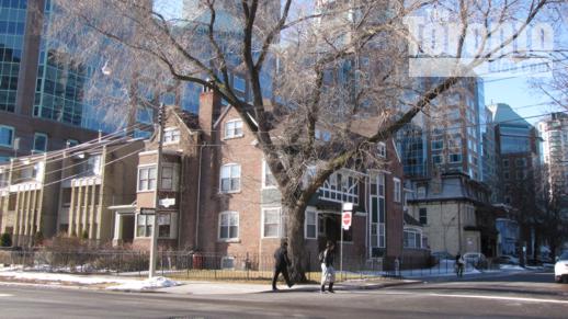
February 28 2011: The northwest corner of Huntley and Isabella Streets, directly across the street from the ETFO building site
 

122 & 124 Isabella Street

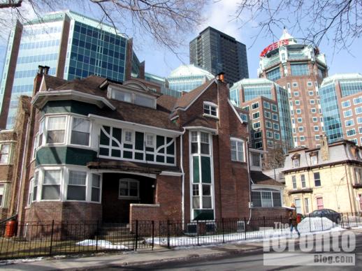
March 1 2011: The building on the northwest corner of Huntley & Isabella is the Samuel R Wickett House, built in 1901 at 122 & 124 Isabella Street. The Rogers Communications building and X Condos tower loom large in the background
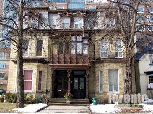
 

30 & 32 Huntley Street

March 1 2011: The Alfred R Williams House and Francis Despard House were built in 1884 at 30 & 32 Huntley Street. Now rental apartments, they sit directly across the street from the ETFO building site
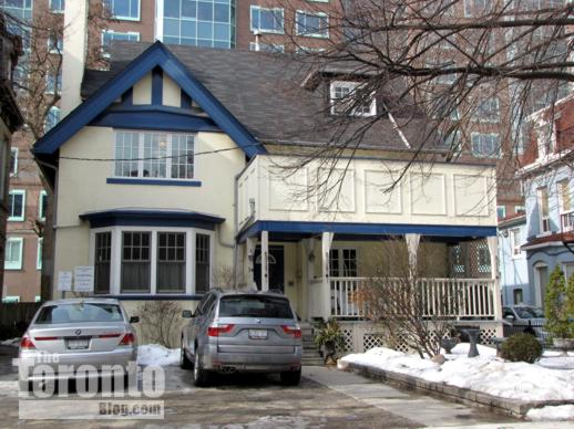
 

Charles E Calvert house at 34 Huntley Street

March 1 2011: The Charles E Calvert house built in 1905 at 34 Huntley Street
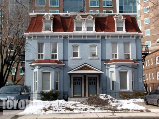
 

George Morphy House at 38 & 40 Huntley Street
March 1 2011: The George Morphy House at 38 & 40 Huntley Street


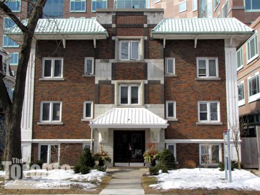
44 Huntley Street apartment building

March 21 2011: The rental apartment building at 44 Huntley Street
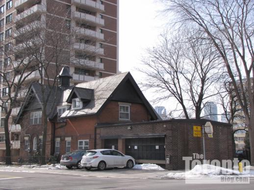
 

119 Isabella Street house built in 1889

March 1 2011: This Coach House at 119 Isabella Street was built in 1889, and is part of the Casey House hospice. It sits on the southwest corner of Huntley & Isabella, kiddy-corner to the ETFO office building site
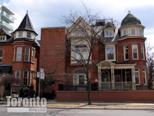
 

Casey House Hospice at 9 Isabella Street

April 2 2011: The Casey House Hospice at 9 Huntley Street sits directly across the street from the ETFO office building site
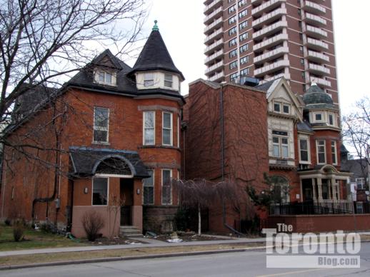
 

127 Isabella Street and Casey House Hospice

April 2 2011: Another view of 127 Isabella Street and the Casey House Hospice at 9 Huntley Street, on the south side of the street across from the ETFO site
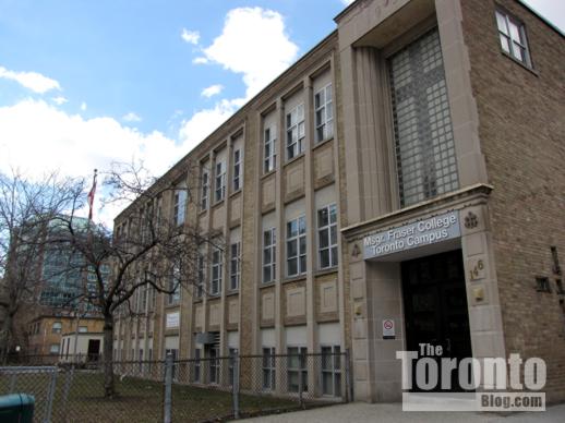
 

Msgr Fraser College on Isabella Street

April 2 2011: The Msgr Fraser College adult learning centre will be the ETFO building’s next-door neighbour on Isabella Street

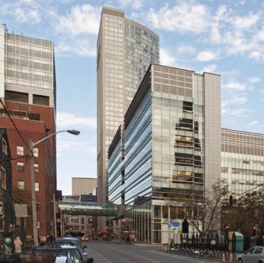
St Mike’s opens research, healthcare centres at new Li Ka Shing Knowledge Institute building

Li Ka Shing Knowledge Institute

West view from along Shuter Street of the Li Ka Shing Knowledge Institute (right) and the tubular pedestrian bridge linking it to St. Michael’s Hospital. Photo courtesy of Elizabeth Gyde/Diamond and Schmitt Architects.
 

Centre celebration: St Michael’s Hospital yesterday celebrated the official opening of its new Keenan Research Centre and Li Ka Shing International Healthcare Education Centre — facilities collectively known as the Li Ka Shing Knowledge Institute. The hospital says the Centres  “are among the first in the world — and the only ones in Toronto — specifically designed to bring together researchers, educators and clinicians to brainstorm ideas across professions and to take best practices and research discoveries to patient bedsides faster.”

The Keenan Research Centre occupies 25,200 square metres (271,300 square feet) with three floors of flexible, open concept wet laboratories and two floors for dry lab study in a wide range of medical research programs. 400 research staff will work there. The building’s education component includes a library, classroom and meeting facilities. These are linked by multi-level lounges that sit above Victoria Lane and are connected by an elegant wishbone staircase, providing a focal point for informal encounters. A 200-seat raked auditorium also serves as a conference centre and lecture hall.

The nine-storey building was designed by Jack Diamond, a principal with Toronto’s Diamond and Schmitt Architects. It occupies the north side of Shuter Street between Victoria and Bond Streets, and is connected to St Michael’s Hospital by a 21-meter tubular glass pedestrian bridge.
A Diamond and Schmitt press release says design highlights of the Li Ka Shing Knowledge Institute building “include a glass curtainwall, which allows natural light to penetrate deep into the building. This serves not only to create an open and engaging workspace but also a visibly accessible connection into the world of medical research for the community at large. Solar shading placed horizontally on the south façade and vertically on the west façade minimizes heat gain and is made of glass instead of the typical metal shades so as not to impede the views to landmark buildings such as St. Michael’s  Cathedral and Massey Hall. Other sustainable features include energy recovery systems on air handling units, reflective roofing, light sensors and a high use of recycled content in materials.”


Will Bloor Street transformation project finally finish before June 16 “red carpet” opening party?
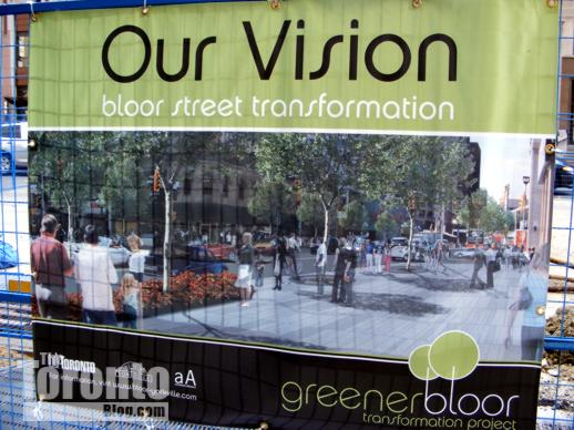
Bloor Street transformation project banner
September 21 2008: A Bloor Street transformation project banner on security fencing along a construction area near the corner of Bloor & Church Street
 

Bloor Street transformation project sidewalk construction
May 13 2009:  Sidewalk construction outside the Hudson’s Bay Centre


Bloor Street transformation construction activity

May 13 2009: Bloor Street traffic is squeezed down to two lanes during construction activity outside the Holt Renfrew Centre


new Bloor Street sidewalk outside the Hudsons Bay Centre

November 22 2009: The transformed streetscape outside the Hudson’s Bay Centre


New Bloor Street sidewalks trees and flowers near Church Street

July 25 2010: Bloor Street East looks beautiful with new sidewalks, trees, lush plants and gorgeous flowers between Park Road and Church Street…


Bloor Street construction activity outside Holt Renfrew Centre

… but on the same day, it’s a different story west of Yonge Street, where there is still a huge construction zone in front of the Holt Renfrew Centre


looking east along Bloor Street from south side of street near the Colonnade

October 3 2010: Construction between Bellair Street and Avenue Road


future tree planting location on south side of Bloor street outside the Manulife Centre

December 21 2010: This tongue-in-cheek sign at a tree planting location got only one thing right: The Toronto Maple Leafs didn’t make it to the Stanley Cup Playoffs. But as of May 1, there still weren’t any new “leafs” on Bloor Street


new tree installation location on Bloor Street at the Manulife Centre

April 30 2011: Trees should soon be planted outside the Manulife Centre


New plants and sidewalks outside Xerox Centre at 33 Bloor East

April 30 2011: The cheery spring flowers brighten the south side of Bloor between Yonge and Church, but some trees still haven’t been planted…


Old sidewalk on Bloor Street outside the One Bloor condo tower future building location

…while the long stretch of sidewalk adjacent to the site of the future One Bloor condo tower won’t be replaced until construction is finished. That means a few more years of waiting before the Bloor Street transformation is complete…


Sidewalk installation outside 120 Bloor Street East office building

…but at least the long-overdue sidewalk replacement outside 120 Bloor Street East, seen here on May 1, will be finished soon


Mink Mile Makeover: After four long years of digging, delays and detours, controversy, cost-overruns and even courtroom drama, the $25 million Bloor Street Transformation Project is nearing completion. With luck, the Mink Mile will look marvellous during the big “red carpet” street party that the Bloor-Yorkville Business Improvement Area (BIA) will be throwing on June 19 to celebrate the new streetscape. I will be among countless Torontonians breathing a collective huge sigh of relief when the City and the BIA confirm that the project is finally finished. After all, it’s about time!

The upscale shopping section of Bloor Street has desperately needed a major makeover for years. The drab streetscape with its narrow white concrete curbs and pavement looked cheap, not chic, and totally lacked any sense of importance, elegance or sophistication — characteristics one would expect for an area that’s often described as Canada’s “premiere” shopping street. Its banal appearance didn’t complement the beautiful luxury goods and fashion boutiques lining both sides of the boulevard. And it certainly didn’t suggest that Toronto is the world-class city it constantly claims and aims to be. I almost felt embarrassed telling visitors from other countries that Bloor Street was the city’s go-to destination for Prada, Cartier, Louis Vuitton and other high-end luxury retail purveyors. Apart from the expensive shops, there was nothing noteworthy or special about Bloor — it was just a typical, tired-looking downtown Toronto street.

So I was thrilled when I heard that the City and the Bloor-Yorkville BIA were teaming up to revitalize part of the Bloor Street strip, and even happier to see the $20 million project break ground in July 2008. Designed by Peter Clewes of Toronto’s architectsAlliance (in joint venture with Brown + Storey Architects), the two-year project promised to give the City a sophisticated streetscape that would finally match its Mink Mile moniker. I looked forward to seeing the wide granite sidewalks with raised planting beds for trees, flowers and shrubs, the new street furnishings and lighting, and the new public art. I felt it was just what Toronto needed to do to transform Bloor Street into a stylish shopping destination on par with high-end shopping districts in major cities around the world.

The project was scheduled for completion in phases over a two-and-a-half-year period, concluding by the end of 2010. However, in typical Toronto fashion, the transformation work got mired in delays, cost overruns and controversy. The project made headlines early on when several Bloor Street businesses launched a lawsuit against the City and the BIA, claiming in part that the project lacked proper prior community consultation and environment assessments. But as was reported in an October 30 2008 article on insidetoronto.com, the Ontario Divisional Court found no improprieties and ruled the project could proceed. Then construction delays started to drag things out considerably. As the Toronto Star reported on May 12 2010, “unforeseen construction problems” put the project months behind schedule and 23% over budget ($4.5 million). More than half of the cost overrun was blamed on Toronto Hydro, which encountered problems and delays burying hydro chambers under the street.

In November 2010, word went out that the work on Bloor Street had finally finished. In a November 23 2010 story, the online publication Building said the transformation project had been finished just in time for the Christmas shopping season, while in a November 29 2010 press release published on its website, Tourism Toronto stated that “Bloor-Yorkville has enhanced its reputation as Canada’s premiere shopping district with the completion of the Bloor Street Transformation Project.” That news struck me as odd, since I had walked along Bloor Street several times in November and noticed that much work remained to be done. Tree and plant installation had not even started west of Yonge Street, and signs said that wouldn’t happen before spring 2011; meanwhile,  a big unrenovated stretch of sidewalk remained as a tremendous eyesore outside the office building at 120 Bloor Street East.

It’s now spring 2011 and there are signs the long-awaited tree and flower planting west of Yonge Street will take place very soon; apparently the BIA is aiming to get all the greenery in the ground by the end of this month. And over at Bloor and Church, crews are finally tackling the ugly section of sidewalk that wasn’t renovated along with the rest of the block.

Though the June 26 street party might suggest the transformation is a done deal, it won’t truly be over for a long time yet. A long section of sidewalk at the southeast corner of Bloor and Yonge hasn’t been touched because that’s where construction is supposed to start sometime later this year or next on the One Bloor condo skyscraper. There’s no point renovating that sidewalk, I suppose, if it’s just going to be covered by hoarding for years and possibly even damaged by construction vehicles and equipment.

Notwithstanding that one missing piece, was the Bloor Street renovation effort really worth the time, trouble, aggravation and pricetag? While I’m sure many frustrated and construction-weary Bloor-Yorkville-area business owners and residents don’t believe so, I think the new streetscape is a wonderful civic investment that will eventually pay off many times over. And even though I don’t patronize those über-expensive designer boutiques, I love walking along the renovated street, and can’t wait to see how it looks and feels this summer once all the trees, plants and flowers are in full bloom.

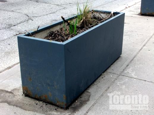
The only thing I’m not happy to see is the abrupt end of the beautiful streetscape a few dozen meters east of the intersection of Bloor and Church Streets. From there to Jarvis Street and farther east to Sherbourne Street, the street looks dull and, in places, downright tawdry and tacky. The City replaced some dead and dying trees on the south side of Bloor Street with paving stones instead of replacement saplings, and though a few new park benches have been installed on the sidewalks between Church and Sherbourne, ugly and rusting metal planter boxes bring a trailer park trashiness to the eastern end of Bloor. The City should have extended the streetscape improvements all the way to Sherbourne; after all, that intersection is one of the gateways to the exclusive Rosedale residential district. But the City’s failure to do so is typical of its usual half-assed approach to civic improvement. I suppose we’re lucky we wound up with even just a few blocks of attractive, world-class streetscape. We could use a lot more, but this is Toronto, after all.

Below are several more recent photos of Bloor Street.


Bloor Street construction zone outside of Holt Renfrew

July 25 2010: Many Bloor Street merchants were furious with the construction delays, but at least Holt Renfrew took matters in stride.


north sidewalk on Bloor Street just west of Yonge Street

May 13 2009: This photo shows how awful the sidewalk looked before renovations reached the north side of Bloor Street at Yonge Street, outside the CIBC  tower.


unrenovated Bloor Street sidewalk outside 120 Bloor Street East

November 22 2009: Only half of the block between Park Road and Church Street was renovated in 2009; the broken and missing paving stones were left untouched on this wide stretch of sidewalk outside 120 Bloor Street East


Sidewalk construction outside 120 Bloor Street East

April 30 2011: At long last, the eyesore stretch of sidewalk outside 120 Bloor Street East has finally been ripped up, and will be replaced with granite pavers


Bloor Street sidewalk outside the Marriott Hotel

May 1 2011: The Bloor Street transformation looks wonderful — except outside the Toronto Marriott Bloor-Yorkville Hotel at 90 Bloor East, where a long section of the old concrete sidewalk remains and completely spoils the new streetscape.


Bloor Street sidewalk outside the Marriott Hotel

May 1 2011: This strip of sidewalk outside the Bloor Street Marriott hotel is a prime example of the City of Toronto’s half-assed approach to civic improvement


Bloor Street planter box on sidewalk east of Church Street

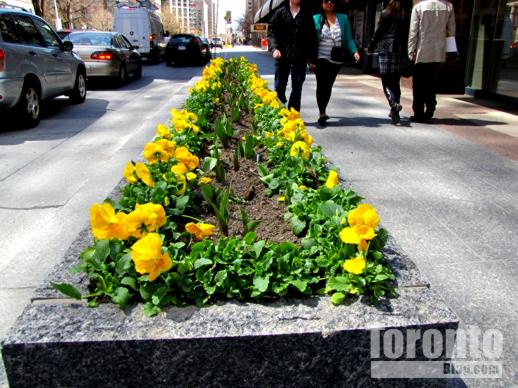
April 30 2011: Yellow pansies brighten the southeast corner of Bloor and Church Streets, but the street transformation ends here. From just a few meters past this planter box all the way to Sherbourne Street, the east end of Bloor looks blah.


South side of Bloor Street between Church Street and Jarvis Street

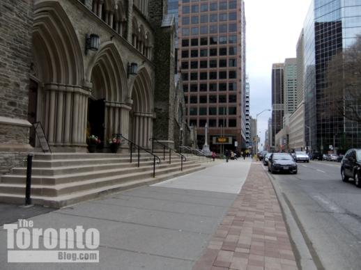
May 1 2011: Sidewalk renovations didn’t continue along the south side of Bloor Street to either Jarvis or Sherbourne Streets. Instead, the city merely uprooted some dead and dying trees and replaced them with paving bricks, like those seen here outside St. Paul’s Bloor Street Anglican Church at 227 Bloor East.


Bloor Street planter box near Jarvis Street

May 1 2011: A rusting metal planter box on the south side of Bloor Street near Jarvis Street contrasts sharply with the gorgeous granite planters two blocks west


City Scene: A BIXI mix-up

BIXI bike station at Jarvis & Charles Streets

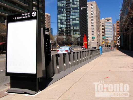
April 30 2011: Notwithstanding what the signage says, this new BIXI public bike rental station (sans bicycles) is actually at Jarvis & Isabella Streets


Big oops!: Things could get off to a confusing start four tourists and even many city residents when Toronto’s new BIXI public bike system launches on Tuesday. The sign on the bike rental station installed this week at the northeast corner of Jarvis and Isabella Streets is mislabelled as “Yonge St & Dundonald St,” which is actually four blocks away to the southwest. I didn’t have time to hike over to Yonge & Dundonald today to see if the station there is marked “Jarvis St & Isabella St” or something else, but can only presume that at least one other station has been installed in the wrong place. Hopefully they will get the station signs sorted out before Tuesday … as well as their website map that indicates rental station locations. Neither the Jarvis & Isabella nor the Yonge & Dundonald stations appear on the map, nor do any of the other dozen BIXI stations I saw while walking around downtown today.

Public urged to pressure politicians to create park on Wellesley St. site of stalled apartment project

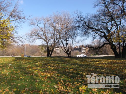
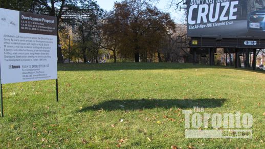
11 Wellesley Street potential city park site

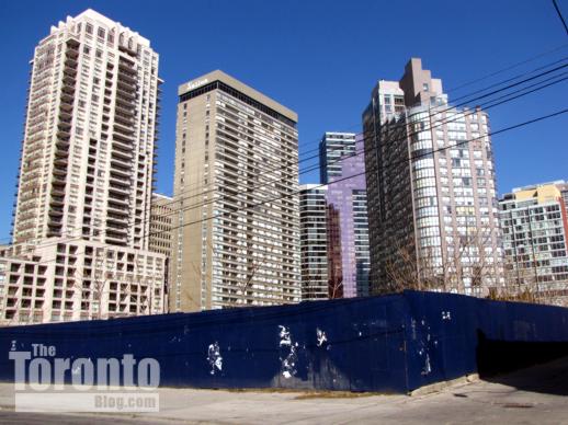
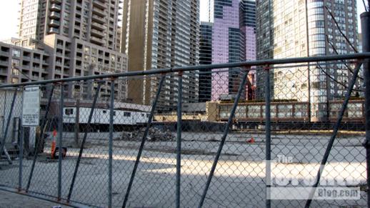
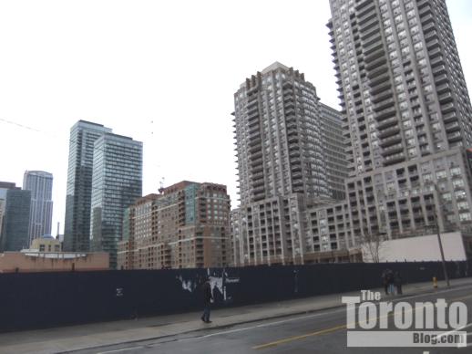
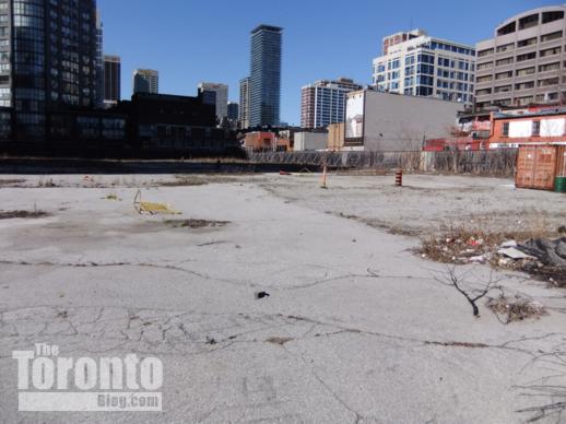
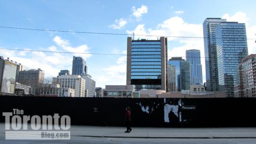
April 19 2011: A southwest view of hoarding around 11 Wellesley St. W., between Yonge & Bay Streets. Behind are the Murano condo towers (left), the Opera Place condos (center) and The Bay Club apartments (right), all on Bay St.


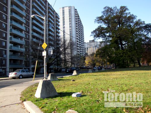
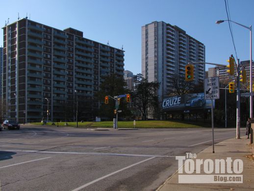
11 Wellesley Street West

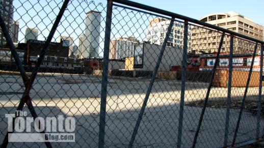
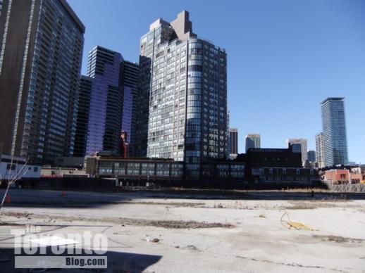
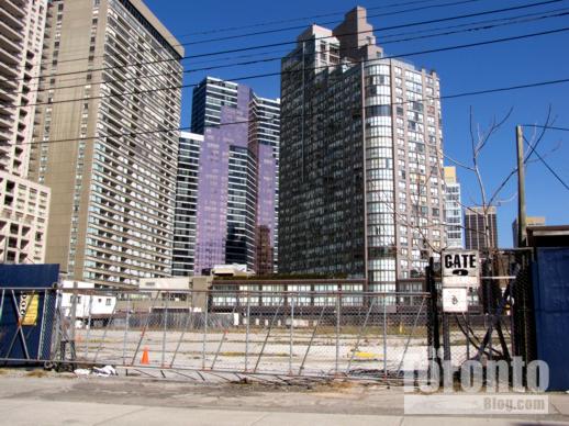
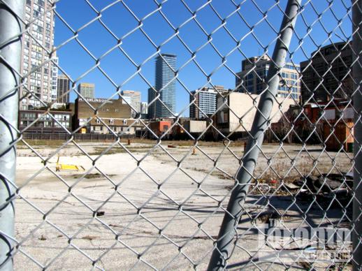
April 9 2011: A northwest view of 11 Wellesley Street West from the corner of Breadalbane St and St Luke Lane. A half-dozen highrise apartment and condo towers, and the Sutton Place Hotel (center), overlook the site.


Potential parkland: Could a big piece of prime downtown real estate become a public park instead of the apartment complex that a developer had planned to build on the site? Apparently so — if enough people can convince city and provincial politicians to make it happen.

The land in question has a municipal address of 11 Wellesley Street West, and occupies the eastern half of the city block bounded by Wellesley to the north, St. Luke Lane to the east, Breadalbane Street to the south, and Bay street to the west. Over the past two decades, it has earned notoriety as a site where ambitious development plans fail to materialize.

Back in the late 1980s, the provincial government donated the entire block of land for construction of a new ballet/opera house. Various levels of government pledged tens of millions of dollars toward the project, and construction of a spectacular building designed by architect Moshe Safdie was supposed to start early in 1991. However, with Ontario in the throes of a recession and facing a $2.5 billion budget deficit, the province’s newly-elected NDP government withdrew its $65 million cash pledge. In turn, the federal government and Metro Toronto cancelled their pledges for $88 million and $20 million, respectively, and the project was cancelled.

A skateboard park occupied the site for a few years until  a developer acquired the western half of the property and built the Allegro at Opera Place condo tower and The Bay Club rental apartment building along Bay Street. The developer, Morguard, planned to build two more apartment buildings, 9 and 10 storeys tall, on the 11 Wellesley West site, along with a recreational amenities facility for the use of residents in all of the buildings (including two more Opera Place condo towers previously constructed one block south on Bay Street, between Breadalbane and Grosvenor Streets). However, shovels never got in the ground for the final phase of construction, and the property has sat vacant behind hoarding ever since — an eyesore that annoys hundreds of residents in the condos and apartments overlooking the site, not to mention passersby on Wellesley and Breadalbane.

I have long wondered why Morguard wanted to build only low-rise apartments on a location ideal for highrise development — to me, tall condo towers would suit the space better, and might even be substantially more profitable. I have also wondered why it has been taking so long for the final phase of Opera Place construction to commence. Last month, a city planning department official told a community meeting I attended that the site has sat empty for years because the developer and the Ontario Government have been embroiled in litigation over the property. No further details were provided about the nature of the dispute, but the planner said the parties are close to signing a settlement under which the province could re-acquire the land. If that does happen, the province apparently has indicated that it would be willing to give the property to the city for use as a community park — if that’s what people want.

Now, at least one neighbourhood group is encouraging residents to write to their city councillor and their MPP to say they want 11 Wellesley West turned into parkland. A page on the Bay Cloverhill Community Association website urges residents to contact City Councillor Kristyn Wong-tam and MPP Glen Murray to show their support for the creation of a new park. Will it happen? Perhaps, if enough Toronto residents put pressure on the local politicians.Personally, I favour turning the site into public green space; even though I didn’t skateboard, I still remember enjoying the wide open space along Wellesley before the skateboard park was closed off. The empty land and the unsightly hoarding have been a blight on the neighbourhood ever since, and it’s high time something creative is done to enhance the property and surrounding streetscapes. At the same time, I’m skeptical that we’ll see a new park on Wellesley anytime soon. Empty land in downtown Toronto rarely gets repurposed as parkland; inevitably, it attracts the attention of developers, and winds up sprouting condo towers instead of trees. Moreover, this particular piece of land seems to have been jinxed since the opera house plan fell apart. I hope I’m wrong. I’d really love to see trees along Wellesley.


11 Wellesley Street West

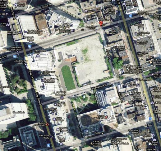
The 11 Wellesley Street West site appears as an empty white space in the center of this aerial image from Google Maps. The Sutton Place hotel is at top left, while the downtown YMCA is near the bottom right.


11 Wellesley Street West

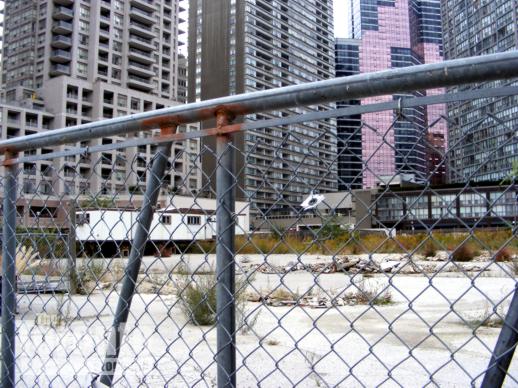
September 28 2008: Breadalbane Street view of weeds and rubble on the 11 Wellesley Street West site


11 Wellesley Street West

September 28 2008: Northeast view from Breadalbane Street


11 Wellesley Street West

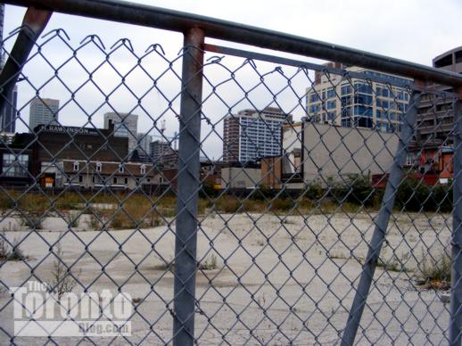
December 5 2008: East view from outside the Sutton Place Hotel


11 Wellesley Street West

December 5 2008: East view from Breadalbane Street


11 Wellesley Street West

April 17 2009: Northeast view from Breadalbane Street. The Casa condo tower is seen under construction on Charles Street to the north.


11 Wellesley Street West

March 11 2010: North view from Breadalbane Street


11 Wellesley Street West

March 11 2010: Breadalbane Street view of 11 Wellesley Street West. From time to time, someone rips out weeds and clears rubbish from the site.


11 Wellesley Street West

March 11 2010: Although there are dumpsters and construction trailers on the property, I’ve never seen anyone on it.

11 Wellesley Street West

March 16 2011:  Southwest view of 11 Wellesley Street West from the corner of Wellesley and St Nicholas Streets. The property is virtually surrounded by highrise condo and apartment buildings.

11 Wellesley Street West

March 27 2011: Looking north at the big empty lot. At left is the Sutton Place Hotel; at center is the Century Plaza condo tower at 24 Wellesley St. W.


11 Wellesley Street West

March 27 2011: A view toward the northeast corner of the lot


11 Wellesley Street West

March 27 2011: The property is less than half a block from Yonge Street and just a short walk from the Wellesley subway station.

11 Wellesley Street West

April 1 2011: South view of 11 Wellesley Street West from St Nicholas Street


11 Wellesley Street West

April 9 2011:  Now that it’s spring, weeds will once again flourish on the lot


11 Wellesley Street West

April 9 2011: This north view will change in a few years during construction of the 45-storey Five Condos, which will rise behind the brown building at upper left.


11 Wellesley Street West

April 9 2011: Residents of the condo and apartment towers have looked down on this eyesore for more than a decade

Hoarding along Breadalbane Street

April 9 2011: West view of hoarding along Breadalbane Street

11 Wellesley Street West

April 9 2011: North view of the hoarding along St Luke Lane

11 Wellesley Street West

April 9 2011: Breadalbane Street view of the towers to the north and west

Hoarding along the west side of St Luke Lane

April 9 2011: South view of the hoarding along St Luke Lane

hoarding on the north side of 11 Wellesley Street West

April 9 2011: Looking west along Wellesley from the corner of St Luke Lane

11 Wellesley Street West

April 17 2011: More rubbish, rubble and weeds await a spring cleanup


Condo highrise expected for former gas station and donut shop site at Wellesley-Sherbourne corner

159 Wellesley Street East

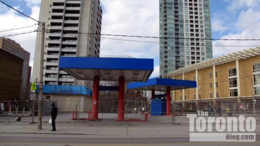
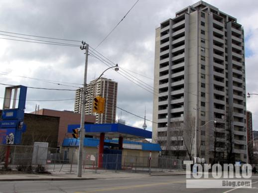
Area residents expect that a condo highrise will be proposed for the southwest corner of Wellesley and Sherbourne Streets, seen here on November 11 2010.


159 Wellesley Street East potential condo development site

March 22 2011: The 159 Wellesley Street East site viewed from Sherbourne Street. At left rear is the rental apartment building at 155 Wellesley St. E.; at right rear is the green and white 40-storey Verve condo tower.


159 Wellesley Street East potential condo development site

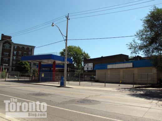
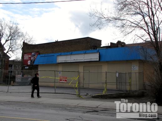
August 29 2010:  The boarded up gas bar and donut shop at 159 Wellesley Street East, viewed from the north side of Wellesley Street


159 Wellesley Street East potential condo development site

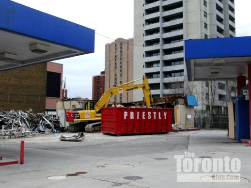
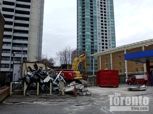
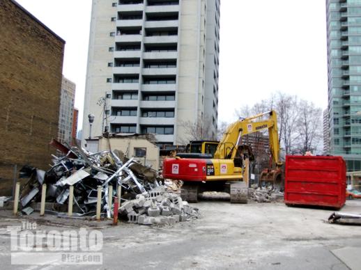
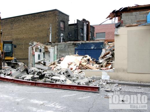
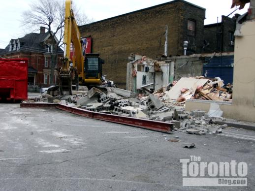
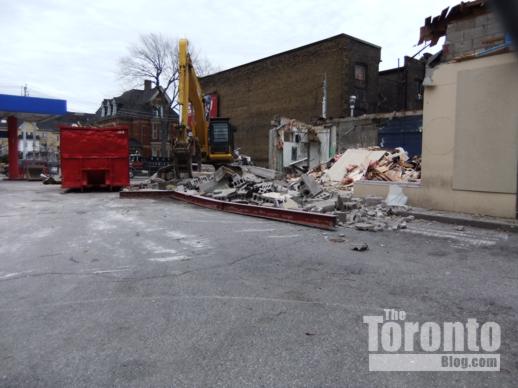
April 19 2011: Demolition of the former Bakers Dozen donut shop


159 Wellesley Street East potential condo development site

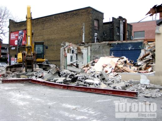
April 19 2011: Demolition of the former Bakers Dozen donut shop


Corner condo? A condo highrise project is apparently in the works for an oddly-shaped parcel of land formerly occupied by a gas station and donut shop at the southwest corner of Sherbourne and Wellesley Streets.The site, at 159 Wellesley Street East, had been occupied for well over a decade by a Beaver Gas Bar and a Baker’s Dozen donut shop. After the two businesses ceased operations when their leases expired early last summer, the site was fenced off and “for sale” signs were posted on the property. The signs came down a few months ago, and word on the street was that the land recently sold for more than $2 million.  Today, a small work crew was busy demolishing the donut shop.

I do know that a developer has discussed potential plans for the site with City planning staff; however, no formal development proposals have been filed yet.  Nevertheless, area residents fully expect that the developer will apply sometime this year for rezoning approval to build a condo tower. This northeast downtown neighbourhood, already home to numerous apartment and condo towers built between the 1960s and mid 1980s, has been a hotbed for residential construction in recent years. Two major condo highrise complexes, Verve and 500 Sherbourne, as well as a lowrise loft condo, Steam Plant Lofts, have opened across the street from 159 Wellesley on the site of the former Wellesley and Princess Margaret hospitals. Just one block to the east, the Star of Downtown midrise condo tower and townhouse complex opened two years ago, while residents recently started moving into the new James Cooper Mansion condo complex four blocks north, at Sherbourne and Linden Streets. Five more residential towers have been proposed for the area, including a rental tower one block north on Sherbourne, and four condo skyscrapers for a North St James Town location between Sherbourne and Parliament Streets, at Bloor Street.

I live nearby, and would welcome a condo on the Wellesley-Sherbourne corner — especially if the developer were to propose building a stunning, unique design that takes full advantage of the property’s unusual shape (the north side of the lot follows the curve on Sherbourne Street). It would further enhance a popular residential area which has already improved considerably with the addition of the other new condo towers and townhouses I mentioned above. I definitely won’t miss the donut shop and its sleazy clientele, and I’m glad I no longer have to dodge the taxi cabs and other vehicles that used to barrel across the sidewalk as drivers rushed to and from the gas pumps. Heck, if I had a dollar for every time I was nearly struck or sideswiped by a car while I walked past the Beaver Gas Bar, I could probably make a down payment on a condo in the building that might go up there.

Below are recent photos of the 159 Wellesley site, as well as other buildings in the immediate vicinity.


159 Wellesley Street East potential condo development site

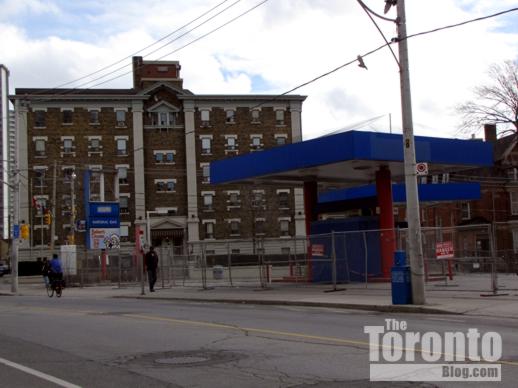
March 22 2011: Former gas bar and donut shop viewed from the northwest corner of Sherbourne and Wellesley Streets


159 Wellesley Street East potential condo development site

March 22 2011: The Bakers Dozen donut shop at 159 Wellesley St. E.


159 Wellesley Street East potential condo development site

March 22 2011: The former gas bar viewed from the north side of Wellesley St.


477 Sherbourne Street apartment building

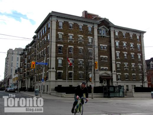
March 22 2011: An apartment building at 477 Sherbourne Street


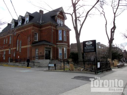
Rosar-Morrison funeral home at 467 Sherbourne Street

March 22 2011: The Rosar-Morrison funeral home at 467 Sherbourne, directly across the street from the former gas bar and donut shop


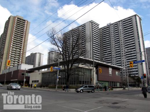
St James Town community centre

March 22 2011: The St James Town community centre and library on the northeast corner of Wellesley and Sherbourne Streets. At rear are several of the apartment towers of the St James Town neighbourhood including 200 Wellesley St. E., scene of a spectacular highrise fire last September.


Sherbourne Street north of Wellesley Street

March 22 2011: Looking north on Sherbourne Street from Wellesley Street


159 Wellesley Street East potential condo development site

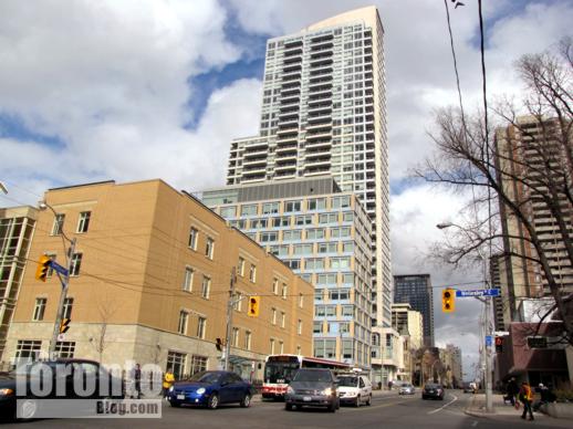
March 22 2011: Northwest view from Sherbourne Street toward the 159 Wellesley Street East potential condo site. At left is the Verve condo tower; at right is the 500 Sherbourne condo tower.


Wellesley Central Place Rekai Centre

March 22 2011: The Wellesley Central Place long-term care facility on the northwest corner of Wellesley and Sherbourne Streets.


159 Wellesley Street East potential condo development site

March 22 2011: Sherbourne Street view of 159 Wellesley Street East


159 Wellesley Street East  potential condo development site

March 22 2011: View from Sherbourne Street toward the corner site


West side of Sherbourne Street below Wellesley Street

March 22 2011: The building immediately south of the 159 Wellesley site


west side of Sherbourne Street below Wellesley Street

March 22 2011: Commercial businesses and the Our Lady of Lourdes elementary school at 444 Sherbourne Street, just south of Wellesley.


159 Wellesley Street East potential condo development site

April 19 2011: Demolition of the former Bakers Dozen Donuts building


159 Wellesley Street East potential condo development site

April 19 2011: Demolition of the former Bakers Dozen Donuts building


159 Wellesley Street East potential condo development site

April 19 2011: Demolition of the former Bakers Dozen Donuts building


159 Wellesley Street East potential condo development site

April 19 2011: Demolition of the former Bakers Dozen Donuts building


159 Wellesley Street East potential condo development site

April 19 2011: Demolition of the former Bakers Dozen Donuts building


59 Wellesley Street East potential condo development site

April 19 2011: Demolition of the former Bakers Dozen Donuts building